

- About Us
- Information
-

The Author ensures that the research has been conducted responsibly and ethically with adherence to all relevant regulations. read more..
- For Authors
- For Reviewer
- Manuscript Guidelines
- Membership
- Publication Ethics
-
- Journals
- Reprints
- e-Books
- Videos
- Policies
- Contact Us
 COVID-19
- Submissions



Abstract
Aspects in Mining & Mineral Science
Multi-Sensor Remote Sensing for Hydrothermal Alteration Mapping and Copper Prospectivity in the Skardu Region, Pakistan
-
Open or CloseZakaria Hussain1, Jaffer Raza2, Zeenat Khan3*, Gulzaib Jahangir4, Basir Ali5 and Mahin Jamil6
1 Department of Earth Sciences, Quaid-e-Azam University, Pakistan
2 University of Azad Jammu and Kashmir, Pakistan
3 Research Analyst, Al-Mussawir Engineers, Pakistan
4 Pir Mehr Ali Shah Arid Agriculture University, Pakistan
5 Department of Geography and Geomatics, University of Peshawar, Pakistan
6 Department of Civil Engineering, University of Engineering and Technology (UET), Pakistan
*Corresponding author:Zeenat Khan, Research Analyst, Al-Mussawir Engineers, Rawalpindi, Pakistan
Submission: June 22, 2026: Published: July 27, 2026
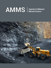
ISSN : 2578-0255Volume15 Issue 2
Abstract
Hydrothermal alteration minerals are important indicators of copper mineralization, but their reliable detection in rugged mountainous terrains remains challenging because of spectral mixing, complex geological settings, and limited field accessibility. This study presents an integrated multi-sensor remote sensing framework for hydrothermal alteration mapping and copper prospectivity assessment in District Skardu, Gilgit-Baltistan, Pakistan, within the Karakoram orogenic belt. ASTER, Sentinel-2A, and Landsat-8 datasets were integrated using diagnostic band-ratio indices and Spectral Angle Mapper (SAM) classification to delineate quartz, clay, carbonate, and iron-oxide alteration assemblages. Mineral endmembers derived from the USGS Spectral Library were used to classify alunite, kaolinite, illite, hematite, goethite, dolomite, calcite, epidote, and quartz. The results demonstrate the superior performance of ASTER for hydrothermal alteration mapping, identifying substantially larger and more spatially coherent alteration zones, including alunite (43.04km²), calcite (28.81km²), dolomite (159.28km²), epidote (176.86km²), goethite (432.02km²), hematite (244.11km²), kaolinite (51.84km²), and quartz (77.17km²), compared with Landsat-8. Band-ratio analysis further showed that ASTER mapped a larger quartz-rich area (127.95km²), whereas Sentinel-2A more effectively delineated clay-rich zones (82.08km²), highlighting the complementary strengths of high spectral and high spatial resolution sensors. Validation using field observations and the Shahzad International Pvt. Ltd. mining lease at Shigri Balla demonstrated strong spatial correspondence between mapped alteration zones and known mineralized areas. Unlike previous studies that primarily relied on individual ASTER or Sentinel imagery for hydrothermal alteration mapping, this study integrates ASTER, Sentinel-2A, and Landsat-8 within a unified framework combining spectral indices, SAM classification, and field validation to improve the reliability of hydrothermal alteration mapping and copper prospectivity assessment in the complex Himalayan terrain of northern Pakistan. This integrated workflow provides a cost-effective, scalable, and reproducible approach for regional mineral exploration in remote and tectonically active regions.
Keywords:Hydrothermal alteration; Copper prospectivity; ASTER SWIR; Spectral angle mapper (SAM); Sentinel-2A; Multi sensor remote sensing
Editor In Chief





.jpg)




























Signup for Newsletter

Quick Links
 Editorial Board Registrations
 Submit your Article
 Best Paper of the Volume
 Reprints
 Refer a Friend
 Advertise With Us
Our Recent Edition
.jpg)


Top Editors




.jpg)
















.bmp)
.jpg)
.png)
.jpg)












.jpg)





.png)

.png)




.png)




Financial Support

Sponsors

Latest e-Books

Latest Video

 a Creative Commons Attribution 4.0 International License. Based on a work at www.crimsonpublishers.com.
Best viewed in
a Creative Commons Attribution 4.0 International License. Based on a work at www.crimsonpublishers.com.
Best viewed in 
 | Above IE 9.0 version