
- About Us
- Information
-

The Author ensures that the research has been conducted responsibly and ethically with adherence to all relevant regulations. read more..
- For Authors
- For Reviewer
- Manuscript Guidelines
- Membership
- Publication Ethics
-
- Journals
- Reprints
- e-Books
- Videos
- Policies
- Contact Us
 COVID-19
- Submissions


Full Text
Environmental Analysis & Ecology Studies
Assessment of Physical Planning Administration in Nigeria
Owolabi Babatunde Oluwaseyi*
Department of Urban and Regional Planning, Nigeria
*Corresponding author: Owolabi Babatunde Oluwaseyi, Department of Urban and Regional Planning, Nigeria
Submission: December 03, 2018;Published: February 11, 2019

ISSN 2578-0336 Volume5 Issue1
Abstract
This Study gives an account of the’’ Assessment of Physical Planning Administration in Akko North West local Government Area of Ondo, state Nigeria with the view to ensure sustainability of the physical environment and some recommendations were made. Primary and secondary sources of data relevant to Physical Planning Administration were collected and well-structured questionnaires were used for collection of primary data. The questionnaires were designed for Community/Property Developers, Community Heads, the Planning Consultants and the Area Urban and Regional Planning officer; of which 124 pieces of questionnaires were administered. The Area officer for the Area Urban Planning Office for the local government was interviewed and he provided information about functions of the Area Planning office in the local government which is to coordinate, control and monitor Physical Planning Development and the staff organizational structure. Simple random sampling technique was used to administered questionnaires in which each case is given equal chances of been selected. The total population of houses in the local government is 24,565 of the total population which is 124 buildings were randomly sampled. Some of the findings of this study are; the Agency is short staffed and it only has one motor cycle for carrying out monitoring of development control in the area, there is no single approved layout plan in the area and that the level of awareness of the community to planning activities are moderate, this study recommend that the government should recruit more staff and master plan should be provided especially for the local government headquarter for effective administration of physical planning in the area.
Keywords: Assessment; Physical; Planning; Administration; Nigeria
Introduction
Background of the study Planning has been described in various ways as land Use Planning, Town and Country Planning, Urban and Regional Planning or Physical Planning Olajuiyigbe & Rotowa [1]. America Planning Association State that the goal of Land Use Planning is to further the welfare of the people and their communities by creating convenient, equitable, healthful and attractive environment for present and future generation America Planning Association 2011 [2]. Physical planning involves the reconciliation of land use provision of right site for the right use, control of development, provision of facilities, services and goods preservation, protection and conservation of resources, preserves heritage among others Oduwaye [3]. Land use planning is done to identify alternatives for land use and to select and adopt the best land use options, the main objective of land use planning is to allocate land uses to meet the economic and social needs of people while safeguarding future resource World Bank 2010 [4]. Physical Planning carried out today will not only affect man and its environment of the present generation it goes a long way to affect the future generation, hence there is the need to plan ahead of the present generation. As the population keeps increasing the resources, we have today will not be sufficient for the future generation because if these resources are not well plan for and utilizes, they will disappear faster than expected especially the non-renewable resources. Administration is the government, political organization comprising individuals and institution authorized to formulate public policies and conduct affairs of state.
Physical Planning Administration is therefore a branch of Public Policy encompassing various disciplines which seek to Regulate Land Use in an efficient and ethical way, thus preventing Land Use Conflict. Physical Planning Administration is not a new concept in Nigeria it has started before the involvement of the Colonial Master into the Country as far back as 1800s where Local Methods of Administration was used. The new thing about Physical Planning Administration in Nigeria is that various approaches have being adopted in solving Physical Planning Issues in the society and Laws have be promulgated to guide its Administration the major Nationally adopted law is the 1992 Nigerian Urban and Regional Planning Decree 88 of 1992. To accomplish the emerging planning practice exposition of planners were the Town Planning Registration Council law which institutionalized professional planning and the first nationwide contemporary planning legal framework, the 1992 Urban and Regional Planning Law NITP 2010.
Research problem
Physical Planning also known as Urban Planning, by whatever discipline it may be given, is an emerging paradigm, and it provide as broader view of relationships between the use of space and the consequences of using it is a particular form, it is an important administrative action aimed at sustaining and improving the aesthetic nature of a town Am Ujiri 2001. But the Administration of Physical Planning in Akoko North West local government of Ondo state is faced with challenges ranging from the government agency to the entire communities. Some of this challenge is; Problems of Living and Housing Living Condition, Political Interference, Development of Illegal Structures, Violation of Planning Rules and Regulations, Development of Buildings on Layouts that has no Approval of the Relevant Agency and the host of others. Despite the effort of successive Administrations in Nigeria in ensuring Qualitative Developmental Control through Urban Planning, the Problems of Urban Planning is still a fact of life in many urban areas in Nigeria today Am Ujiri 2001 of which Akoko North West Local Government Area cannot be exempted. Thus, the focus of this study is on Akoko North West Local Government Area of Ondo state Nigeria.
Justification for the study
There is the need to examine the status of Physical Panning Administration in the area in or order to identify its challenges, the roles of the Government Agencies in Physical Planning Administration, and to Enlightens the Citizens the need to Safe Guard the Physical Environment as the biggest asset of Man for the present generation without jeopardizing the future generation from enjoying the Physical Environment. Planning is therefore directed to the future, learning from the past and typically trying to preserve its strengths and opportunities.
Aim and objectives
Aim of the Study: The aim of this study is to assess Physical Planning Administration in Akoko North West local Government Area of Ondo state in view of ensuring sustainability of the physical environment.
Objectives: The objectives are to:
A. Identify agencies responsible for the Physical Planning Administration in Akoko North West Local Government of Ondo state
B. Identify the roles played by the development control unit in controlling physical development in the study area
C. Examine the level of compliance of the developers with the existing planning standards and regulations guiding development in the area
D. Identify the problems encountered in the physical panning administration in the area
Research questions
A. What their agencies responsible for Physical Planning Administration in the study area?
B. What are the roles of Development Control Unit of the Agencies and Corporations?
C. Do the Property Developers comply with Planning Regulations?
D. What are the problems of Physical Planning Administration in the study area?
Definitions of relevant terms
Physical planning: Generally referred to as town planning is the act of controlling the use of land and the character of buildings and communication routes so as to achieve economy secure convenience and beauty.
Administration: Is the government, political organization comprising individuals and institution authorized to formulate public policies and conduct affairs of state.
Physical planning: Administration is therefore a branch of public policy encompassing various disciplines which seek to regulate land use in an efficient and ethical way, thus preventing land use conflict.
Property: Developer is a person or company whose job involves buying and selling buildings and land and rearranging for new buildings to be built (Cambridge Advanced Learner’s Dictionary).
Land: Includes any building and any other thing attached to the earth or permanently fastened to anything so attached but does not include minerals (NURP Decree 88 of 1992).
Geographical location of Ondo State
Geographically, Ondo state lies between latitudes 50o 45’N and 70o 52’N and longitudes 40o20’E and 600 3’E. Its land area is 15,000 square kilometers. Ondo state was one of the seven states created on 3rd February 1976 with Akure being the state capital. It was carved out of the former Western Region. The state is bounded on the East by Edo and Delta states, on the West by Ogun and Osun states, on the North by Ekiti and Kogi and to the South by Bright of Benin and Atlantic Ocean. Ondo state is one of the eight states of the federation with coast line. The population is put at 2,355,728 (1991census), the current population however put the state at over 3 million people.
The state has widespread tourism features. There are maze creeks, river and lakes in the coastland area. Lowlands ragged hills and granite outcrops are found in most part of the state like Idanre, Oke-agbe Akoko and Oka Akoko. Some notable rivers in the state are Owena, Ogbese, Ose and Oluwa. Moreover, Ondo State is blessed with unlimited resources starting with good vegetable (rainforest zone), crude oil, bitumen limestone, kaolin as well as vast forest resources and indeed, the famous cocoa trade has a legacy in Ondo State.
The study area; Akoko Northwest local government area
Geographical location of Akoko Northwest L.G.A: Akoko North west local government area is one of the 18 Local government areas in Ondo State, Nigeria. It has is headquartered in Okeagbe town. It is located approximately 700 kilometres south west of Abuja the federal capital of Nigeria and about 350 kilometers to Lagos, (Figure 1) it is located within the tropical rain forest region of Nigeria where rainfall is high. It falls within latitude 7°30” and 7°35’’N and longitude 5°49E the area is accessible by roads and footpaths and occupies about 0.8kmetre squares in aerial extent. It has area coverage of 512 kilometers square.
Figure 1:Map of Nigeria showing Ondo state.Source: Dive GIS.

Population and socio-economic characteristics of the area: Akoko north west local government has a total population of 213,792 peoples as at 2006 population census. It comprises of fifteen towns namely Arigidi, Erusu, Ese, Okeagbe, Ikaram, Ibaram, Ajowa, Eriti, Oyin, Afin, Iyani, Ase, Irun, Ogbagi and Igasi (Figure 2). The towns and villages have traditional monarchs which rule them. This local government is situated in the rocky part of ondo state, each town have distinctive local dialect of their own that is different from others, it is popularly known has the home of education. The majority of the people living in the area are agrarians; they produced crops like cassava which they processed locally into Garri, Fufu and Elubo (Cassava flour), Yam, Cocoa and Coffee.
Figure 2:Map of Ondo state showing akoko north west local government. Source: Dive GIS, 2018.

Geology of the study area: Akoko north west local government is situated in the deciduous rainforest area in south western Nigeria. It has evergreen vegetation and urban settlement; the vegetation of this area reflects the rainforest and guinea savannah’s vegetation which is characterized by different plants and trees which may reach the height of 5 mertes and even more. They consist of light forest, shrubs, and scattered cultivation. There areas where rocks are covered by vegetation which is also an indication of posterity of the rocks and function of the grain size, trees and plants like timber, oil palm, and kola nut, rubber, cocoa and citrus are very prominent in these areas. A high forest zone is found in the north while the southern part is mostly sub savannah due to farming activities in the area which has actually reduced the thickly vegetated area.
Topography of the study area: The topography of the area is made up of undulating high and low relief; Akoko generally has their highest point range from 432 metres to 490 metres and their lowest point range from 321 metres to 201 metres above the sea level, the high land vary in sizes and shape from ridges which can traced for several for several kilometers to dome to inselbergs and to boulders which may be capping/hanging on the high or sitting on the lowland. Some of the rocks appear as low lying.
Literature Review and Conceptual Framework
Literature review
History of physical planning in Ondo State: Physical Planning Administration in Ondo state has stated before the involvement of the colonial masters into the country were the local method of administering land uses is implored and the community land is vested into the hands of the obas, cheifs and patterned after the local customs of the people, while family land is vested into the hands of the family head whose legal status was that of a trusted beneficiary and can allocate reallocate and supervised. In Ondo state, the Town and Country Planning Law was first enacted with the State Development Welfare Plan were allocation was made for village reconstruction schemes and town.
Ajowa village regrouping scheme was the only noticeable Physical Planning activity carried out in the then Ondo province town and country reconstruction group and it was implemented by the building and town development committees of Ajowa which a planning committee was not but a Community Development Committee, but it did perform some Town Planning functions. In Ondo State, the 1964 Town and Country Planning law was enacted which gave rise to ten-year development welfare plan whereby allocation was made for town planning authorities (TPAs) established in the western region was in Ondo province, therefore activities related to Physical Planning are carried out by the village heads or chiefs in collaboration with sanitary inspectors attached to the local government councils.
The committee was a Community Development Committee and not a Town Planning Authority. It was due to the 1946, Nigerian Town and Country Planning Ordinance that the Western Regional Government enacted the Town and Country Planning Law, thus the enforcement of this law was the responsibility of the Town Planning Division under Ministry of Lands Works and Housing. The law established Town planning Authorities to control and guide the orderly development within their jurisdiction by approving proposals for physical development, development scheme and land use plans. Twelve Town Planning Authorities (TPAS) were established in the Western Region of which only two were in Ondo province, Ado-Ekiti and Ajowa between 1956 and 1960. The total number of Town Planning Authority established in Ondo province rose to nine, Ijero, Ikole, Ado-Ekiti, Ikere, Ajowa, Ikare, Owo, Ondo, Okitipupa by 1963 Planning.
Presently in the state, there are Eighteen (18) Urban and Regional Planning Area Offices in each local government areas. In February, year 1973 the state was created by the then administration of late General Muritala Mohammed from the western state with its capital city in Akure which originally include Ekiti state which was separated from it in October 1996. The Town and Country planning law cap (123) governing the western region was copied into ondo state town and country planning law cap (123). The ministry of Land and Housing was created with the division of town planning to be in charge of physical planning administration and it has local planning authorities all over the state but they were faced with the challenge of poor staffing which result into ineffective monitoring of physical planning activities in the state Olujimi [5].
The major noticeable projects embarked then were road and building construction by the government. Three years after the creation of the state a unified town planning control system was adopted which cantered all town planning activities in the Town Planning Division of the State Ministry of Works and Housing. All assets and liabilities, including staff of the defunct TPAs, were taken over by the Town Planning Division of the Ministry, which in turns established Area Urban and Regional Planning offices in each of the local government headquarters throughout the state Olujimi [5].
In 1979 the then government give out the preparation of Master Plans for Akure, Ondo, Owo, Ikare and Ado-Ekiti and that of Akure and Ondo was completed before 1983 and that of the other was completed later. Low cost building houses was also built by the Federal Government with the need facilities and infrastructure but was vandalized and abandon due to political reasons. Examples of this estate are the Shagarri housing estate in Akure the capital city and Ikare. In 1999, Ondo State passed into law the Ondo State Planning Board and Local Planning Authorities Edict 2 of 1999. The Edict aimed at correcting the problems created by the excessive centralization of planning administration and also the shortcomings of the 1946 Ordinance under which physical planning was being operated in Ondo State. As good as the Edict was, it was never implemented Olajuigbe & Rotowa [1].
In 1992 the enabling law of Ondo State Capital and Urban Development Authority (CUDA) was established but it was not implemented due to political instability which was later implemented in the state capital only with the construction of the market popularly known as Onyaregbulem Ultra-Modern Market at Shagari estate junction along Ilesa-Owo express road. The Nigeria Urban and Regional Planning law Decree No 88 of 1992 was promulgated and was domesticated in Ondo state under the Regional Planning Board and Local Planning Authorities Edict No. 2 by the Fasanyan administration in 1999 (ODSG, 1999). In 1999, Ondo State passed into law the Ondo State Planning Board and Local Planning Authorities Edict 2 of 1999. The Edict aimed at correcting the problems created by the excessive centralization of planning administration and also the shortcomings of the 1946 Ordinance under which physical planning was being operated in Ondo State. As good as the Edict is it was never implemented [1].
In February 2009 the Ministry of Physical Planning and Urban Development were created out of the former Ministry of Lands, Housing and Environment in February 2009 by the Administration of Dr. Olusegun Mimiko, The need to create a separate Ministry for Urban Development became necessary in view of the rapid rate of urbanization in the state and the desire to address the critical issues of Urban Planning and Management in order to stem the tide of slum development across the state, This Administration considers Urban Planning as a significant management tool for dealing with the unprecedented challenges facing the state in ensuring decent and sustainable towns and cities. In the year 2013 the ministry has been merged with the ministry of housing as a result of the state government directive for effective physical planning administration in the state.
Physical Planning is a design exercise that uses the Land Use Plan as a framework to propose the optimal physical infrastructure for a settlement or area, including infrastructure for public services, transport, economic activities, recreation, and environmental protection [4]. Physical Planning has been defined as concerned with the design, growth and management of the physical environment in accordance with a predestined guide and policies. Its goal is to make provision for the coordination of all forms of development activities at the national regional and local level [6]. Physical Planning commonly referred to as “Town Planning” is the process that involves the spatial ordering of land uses both in the urban and rural settings for the purpose of creating functionally efficient and aesthetically pleasing physical environment for living, working, circulation and recreation.
Planning agencies: In Nigeria Urban and Regional Planning Decree No 88 of 1992-part (1A) section1explain Plan Preparation and Administration and the types and levels of physical development plans to prepared at the federal, state and the local government level and part (1B) state the responsibilities of the three tiers of government. And in C certain bodies that will be responsible for Physical Planning Administration were established at the federal level, state level and the local level.
For the purposes of the initiation, preparation and implementation of the National Physical Development Plans, the Federal, State and local governments shall establish and maintain respectively-
A. A National Urban and Regional Planning Commission (hereafter in this Act referred to as “the Commission”).
B. A State Urban and Regional Planning Board (hereafter in the Act referred to as “the Board”) in each of the States of the Federation and the Federal Capital Territory, Abuja; and
C. A Local Planning Authority (hereafter in this Act referred to as “the Authority”) in each of the local government areas and the area councils of the Federation.
In Ondo state the state board refer to as the Ministry of Housing and Urban Development is the agency in charge of Physical Planning Administration in accordance with the Nigeria Urban and Regional Planning Decree 88 of 1992 and they have area office in each of the eighteen local government of the state they do not have Local Planning Authority at the local government level as stipulated in the decree mention above as a result of this planning at the local level in the state is not effective because each level as their composition and function stated in the decree which cannot be performed effectively by another level. In 1973 Ondo state was crated which include the present Ekiti state.
‘The Town and Country Planning Law Cap (123) governing the western region was copied into Ondo state town and country planning law cap (123) The ministry of Land and Housing was created with the division of Town Planning to be in charge of Physical Planning Administration and it has Local Planning Authorities all over the state but they were faced with the challenge of poor staffing which result into ineffective monitoring of physical planning activities in the state [5].
Ondo State government enacted the State’s version of the 1992 National Urban and Regional Planning Law in 1999 several years after the enactment; it is yet to be implemented. In order to adequately decentralize planning functions, the 1992 National Urban and Regional Planning law made provisions for three tiers of governance these are; the National Urban and Regional Planning Commission at the federal level; the State Urban and Regional Planning Board at the state level and a Local Planning Authority (LPA) in each of the local Government Areas and the Councils of the Federation [1]. But the state did not fully implement the decree because all planning activities were consecrated in the state capital while the local government area were left behind, in other for planning activities to be more effective there is the need for decentralization of power in the state by creating local planning authority in each local government area which will enable the people at the grass root to be more familiar with planning activities and income can be generated from there to carry out planning oriented programmed that will benefit the people and the environment at large Aribigbola [7]. Therefore, calls for decentralization of physical planning in Nigeria using Local Planning Authority as its plank.
Olajuiyigbe & Rotowa [1] said that Prior 2008 in Ondo physical planning activities was centered under a Ministry (Ministry of Works and Transport or the Ministry of Lands and Housing), Under this arrangement, Physical Planning became very ineffective since it has to compete with the activities of other Departments in the Ministry for both human and financial resources, it was in realization of this challenge that the government created a new Ministry of Physical Planning and Urban Development in 2008 with a substantive commissioner. This decision was to usher in an era of efficient and sustainable Physical Planning process in the State. In the year 2013 the Ministry of Physical Planning and Urban Development was merged with the Ministry of Housing.
Development control: Nigeria Urban and Regional Planning Decree 88 of 1992 part 2 defines Development as the means of carry out of any building, engineering, mining or other operation in, on above, under any land or the making of any environmentally significant change in the use of any land or demolition of building including the felling of trees and the placing of free standing erection used for the display of advertisements on the land and expression ‘’development’’ with its grammatical variation shall be constructed accordingly. Development control forms an integral part of the planning practice. It is the basic means by which the state intervenes to regulate the use and development of land in order to implement Local and National Planning Policies. Most significantly it is the part of the planning. Process in which members of the public come into contact with local planning authorities. Leonard Dissanayake. Keeble [8] was of the view that “development control involves regulation of the detailed aspects of development, about which precise guidance cannot be given by the development plan, so as to ensure convenient and slight results”.
Development control is a tool use by the control department in controlling the unguided activities of man, developers takes law into their hands and do what they feel is convenient for them even though is causing hazard to life and property in the environment. The goal of development control is to ensure that developers conform to planning standard and regulation to make the environment aesthetically pleasing and to ensure sustainability environment.
Establishment and Jurisdiction of Development Control Department, Part two section 27 NURP 1992:
A. The Commission, the Board and the Authority shall respectively establish a department to be known as a Development Control Department (hereafter in this Act referred to as “The Control Department”).
B. The Control Department created under subsection (1) of this section shall be a multi-disciplinary department charged with the responsibility for matters relating to development control and implementation of physical development plans.
C. The Control Department at the Federal level shall have power over the development control on Federal lands and estates.
D. The Control Department at the State level shall have power over the development control on State lands.
E. The Control Department at the local government level shall have power over control of development on all land within the jurisdiction of the local government
Functions of development control: The Nigeria urban and regional planning decree 88 of 1992 part two (Section 28, 30, 32, 35, 43 and 47); Powers and functions of the Development Control Department.
Section 28: Approval of a Planning Authority before development:
A. Approval of the relevant Development Control Department shall be required for any land development.
B. A developer shall submit a development plan for the approval of the Development Control Department.
Section 30: Application for a development permit.
A. A developer (whether private or government) shall apply for a development permit in such manner using such forms and providing such information including plans, designs, drawings and any other information as may be prescribed by regulation made pursuant to this section.
B. No development shall be commenced by any Government or its agencies without obtaining an approval from the relevant Development Control Department.
C. A plan required to be made under this Act shall be prepared by a registered architect or town planner or engineer and shall be in accordance with the provisions of this Act.
Section 32: Consideration of Representation by A Developer
The Control Department may consider representations made to it by a person, body or organization to be affected by an intended development.
Section 35: Enforcement of Rights and Duties Attached to a Development Permit
The Control Department shall enforce all the rights and duties attached to a development permit against a developer: Provided that where a developer transfers or assigns his interest, the Control Department shall enforce all the rights and duties attached to a development permit against a holder or occupier for the time being.
Section 43: Non-payment of compensation for revocation
The amount of compensation payable under section 43 of this Act shall be such as to reimburse the developer or holder for the time of a development permit of the losses incurred as a result of the revocation and shall not be in the form of payment of damages or in excess of the sum incurred by the developer. No compensation shall be payable under this section if
A. A development is not in accordance with the terms and conditions under which the development permit was granted; or
B. the right of occupancy of the land on which a development was to take place has been cancelled or revoked on the ground that the applicant did not comply with the requirements of the Land Use Act;
C. A claim for compensation is made 28 days after a notice of revocation is served on the developer or the holder for the time being of a development permit.
Section 47: Service of Enforcement Notice
A. The Control Department may serve an enforcement notice on the owner of a private residential, commercial, industrial or any other land wherever any development is commenced without its approval.
B. An enforcement notice may be issued pursuant to subsection (1) of this section notwithstanding that the unauthorized development took place before the commencement of this Act.
Instruments used by the Control Department: Enforcement of development control department is perfected using enforcement notices. Enforcement notices are powerful instrument used by the control department to enforce developers to conform to the planning standards and regulations in other to make our physical environment aesthetic, beauty and convenient to ensure sustainability. In part two sections 47-63 of the Nigeria urban and regional planning decree 88 of 1992 establish the issuance form of enforcement.
Before issuing enforcement notices the control department shall:
A. Have regard to the existing conditions for grating a development permit
B. The environment impacts the development has or may have on its environment
C. Overriding public interest
Service of enforcement notice
A. The Control Department may serve an enforcement notice on the owner of a private residential, commercial, industrial or any other land wherever any development is commenced without its approval.
B. An enforcement notice may be issued pursuant to subsection (1) of this section notwithstanding that the unauthorized development took place before the commencement of this Act.
Form of an enforcement notice
A. An enforcement notice served under section 47 of this Act by the Control Department shall-
B. Be in writing and communicated to the developer; State the reasons for the proposed action of the Control Department; Consider any representation made by a developer or on behalf of a developer.
C. An enforcement notice may require a developer to alter, remove, or discontinue a development to ensure that the development becomes a lawful development or becomes compatible with the use for which an adjoining land has been put.
Stop-work order to take effect on service
A stop-work order shall take immediate effect upon service on a developer or the occupier of the development for the time being.
Contravention notice
Where a developer contravenes the provisions of a planning law or any regulation made pursuant to a law, the Control Department shall have the power to require the developer to
A. Prepare and submit his building plan for approval; or
B. To carry out such alterations to a building as may be necessary to ensure Compliance;
C. To pull down the building; or
D. To re-instate a piece of land to the state in which it was prior to the commencement of building.
Demolition
A. The Control Department shall have the power to serve on a developer a demolition notice if a structure erected by the developer is found to be defective as to pose danger or constitute a nuisance to the occupier and the public.
B. Notice served pursuant to subsection (1) of this section shall contain a date not later than 21 days on which the Control Department shall take steps to commence demolition action on the defective structure.
Conceptual frame work
The conceptual frame work will consider sustainable development concept, concept of development control, urban system concept and Good urban governance concept as they relate to physical planning administration.
Urban system: Urban System is described as an ‘organized or complex whole: an assemblage or combination of things or parts that form a unitary whole, which is greater than the simple sum of the parts’. It can also be seen as a network of towns and cities and their hinterland, since it depends on the movement of goods and services, ideas and capital through the network important interaction within the system are efficient system of transport and communication. Technological advancement can make urban system to transcend national boundaries. In Physical Planning the concept of system seeks to defined established framework of organization for effective decision making and policy formulation within an operating system. At every level of organization, there are so many relations and interactions within and between the different levels it is a complicating task if they are going to be separated. The structures within the urban system are complex because it is an open and overlapping system that cannot be easily demarcated because it allows for exchange of social innovation and it has some common features despite the inequalities that exist within it, some of the common features are; adaptation to change, selection, cooperation or limitation which ensure social regulation of the system.
In urban system three important structure which are:
A. Economic structure
B. Social structure and
C. Spatial structure
Good Urban Governance (GUG) concept: Governance by (UNDP) is the exercise of economic, political and administrative authority to manage a country’s affairs at all levels. It comprises the mechanism, processes and institutional through which citizen and group articulate their interest, exercise their legal rights meet their obligation and meditate their differences. The concept of governance is broader them government, it encompasses the following; government, the civic society, and the private sector. Urban Governance is described as the means through which all stakeholder in the society can manage the affair of their cities, town or village and not limiting it to the government alone. In other world it is a joint responsibility of all stakeholders in seeking the welfare of their society.
These stakeholders include; the government, private sector, non-governmental and community-based organization, the media, the professionals and individual members of the community. This governance also focuses on institution and processes, stakeholders must be involving in the processes that in decision making through institutions that seek to improve the quality of physical environment and their wellbeing through good urban governance. The need for good urban governance in physical planning administration is to identify the complex relationship between all stakeholders in the society and work together in unity for effective management of the limited resources available for their use. Good urban governance is one of the areas where physical planning administration is falling in Ondo state.’’ We can improve urban governance by willingness to establish the right institutional frame works, providing the necessary statutory and effectively applying available regulations NITP 2009.
Sustainable development concept: Sustainable Development can be seen as the development that meets the need present generation without compromising the future generation from meeting their needs. According to the United Nations World Commission on Environment and Development 2009, Sustainable development is defined as “development that meets the needs of the present without compromising the ability of the future generations to meet their own needs”. This view emphasizes on how decisions and actions today can affect the future, especially in relation to natural resource availability, environmental health and destruction of local and global ecosystems. As the population of human increased rapidly and the available resources are limited the population then begin to compete with each other for survival without taken into consideration what will become of the future generation, the society that have been able to be self-sufficient as out grown their resources as a result of man quest for development through science and technology they have tempered with the natural environment. Sustainability requires that human activity, at a minimum, only uses nature’s resources at a rate at which they can be replenished naturally Agbola [9].
Physical Environment and its constraints: Human society evolves within, is dependent on, and is part of the global environment. Its development is constrained by the conditions of the global environment: available space; waste absorption capacity of soils, rivers, oceans, atmosphere; availability of renewable and non-renewable resources; soil fertility and climate. Some of these are state limitations (e.g., the amount of delectable resources), others are rate limitations (e.g., the maximum rate of waste absorption). Sustainable development paths must adhere to these constraints. This is a second restriction, of accessibility space.
Development control concept: Development Control is a process whereby development proposal is made to comply with planning rules and regulations before they are fully implemented, its major objectives are to create functionally efficient and visually attractive physical environment.
Development activities are carried out with the help of approved planning standard Agbola [9]. While approved planning standards are planning regulation codes and by laws Agboola & Olatubora 2004.’’ Standards for planning and building regulations are essential in guiding development’’ Leonard Dissanayake [10]. Keeble [8] was of the view that “development control involves regulation of the detailed aspects of development, about which precise guidance cannot be given by the development plan, so as to ensure convenient and slight results”. The concept of development control was developed from the knowledge that many land uses were not separated from another, which lead to incompatibility of land uses Aluko [11].
Research Methodology
Research methodology is the systematic, theoretical analysis of methods applied to a field of study, or the theoretical analysis of the body of method and principles associated with a branch of knowledge Wikipedia 2014. It is a tool that serves as scaffolding for validation, proper analysis and interpretation of data towards guiding a research for realization of the set of goals and objectives Okoko 2000.
Research design
Research Design as a’ blue print’ for research which deals with the problem of question to study, data that are relevant, data to collect and how to analyze the result Wikipedia 2011. This is the procedure and tools used for the analysis of data. Survey research design method for used for the purpose of this research and it makes used of both primary and secondary sources of data collection.
Research population
The target population in Akoko North West Local Government is the entire population of people in the area which was projected to be 71734 with 10247 houses, include the residents, the developers and the agencies in charge of Physical Planning Administration in the area
Sampling frame
Sampling frame is the actual sets of units from which a sample have been drawn, a list of all those in the population who can be sampled and may include household, individual or institution. Stratified random sampling were used for the purpose of this research in selecting the communities based on their population classifications, and simple random sampling was then used to select houses were the questionnaires will be administered.
Sampling technique and sample size
Sampling technique: The technique used in this research is stratified random sampling; this technique is a procedure by which items are grouped into various strata. Source; Author’s Fieldwork 2018.
Sample size: Sample size is defined as the numbers of participant in a given study, for the purpose of this research it is the total numbers of houses selected for sampling in each of the various communities. The communities were grouped into two groups that is Rural and Urban Settlements using population criteria to group them, Settlement with less than 20,000 people is grouped under Rural Settlement while those with above 20,000 people are grouped under Urban Settlement. The Local Government has a total of twenty-seven (27) settlement of which Five (5) were Urban Settlement and twenty-one (22) were Rural Settlement Four (4) Settlements were selected from the Rural category and one from the Urban category 2% of the selected Settlement were sampled. A simple random survey was used to select the houses in the selected Settlement were all the cases are given equal chance of being selected. A total number of 124 questionnaires were administered in the communities at the rate of approximately. 50% of the total numbers of houses as projected in the local government. The population was projected to be 171959 persons while that of the houses is 24,565, this was achieved by dividing the population of human by seven (7) that is household size [12-20].
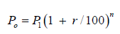
The formula below was used for the projection of the population as stated below:
Where
Po=The Projected Population 2014
P1=Previous Population Census 1991
n=Number of Years (23)
r=Growth Rate (2.54%)
Source: CIA world fact book 2013
Data collection instruments
The research makes used of both primary and secondary sources of data collection. The instrument used is
Reconnaissance survey: The survey was as a preliminary study of Akoko North West Local Government Area in other to have a fore knowledge of the study area and the survey design. I t is a form of an observation research, a systematic process of recording the behavioral the patterns of people, objects and occurrences without questioning or verbal communication with the people.
Observation method: Observation method of data collection for research purposes that is more than just looking or listen, the researcher will carefully be planning of what he wants to observe which will be recorded in some way to allow the information to be analyzed and interpreted. It is an on the site situation investigation for the purpose of ascertain the study area in terms of location, the people, vegetation etc. What was observed in the study area includes the way the physical setting of the environment, the behavioral pattern of the people, the types of structures in the area and if the structures observed adequate setbacks or not and so on.
Oral interview method: An oral interview method is having verbal interaction with the respondents in this method the researcher will prepared a well-structured questions and go to the field and ask the respondents and record the responses down, for the purpose of this research the researcher had oral interview with the area officer of the Akoko North West Local Government Area officer were questions like, functions of the agency, the number of staffs, machinery use for development control and so on.
Primary data: Primary source relates to fresh of raw data obtained by the researcher directly from the field which is usually done through the use of questionnaire, interview and use of electronic and photographic equipment. For the purpose of this research a well set of structured questionnaires was used and the Local Government Area officer was interviewed
Secondary data: Secondary data refers to already collected, processed, analyzed and sometimes interpreted and reconstructed by another researcher which can be in Table 1; Figure 3 and chart. They also include information from agencies and corporations. For the purpose of this research the secondary data was collected from the ministry of Housing and Urban Development Akoko North West Local Government Area office and population commission
Figure 3:Map of Nigeria showing Ondo state.Source: Dive GIS.

Table 1:1991 Population figure of Akoko Northwest local government.

Source; national population commission (NPC) 1991 Census.
Questionnaire method: This is a method in which the sets of questions contained in the questionnaires are prepared in connection with the study which will be analyzed and be interpreted to obtain information needed from the target population. This research makes used of a well-structured questionnaire which are all closed ended for easy analysis and contain two sections section A and Section B and was administered for two categories of respondent which are the communities and the physical planning agencies. A total of 124 questionnaires were used and it was administered by the researcher going to the study area and having face to face contact with the respondents.
Table 2:The projected population and the numbers of houses in the study area.

Source; Author’s Fieldwork, 2018.
Method of data analysis
Data analysis is the stage, where the researcher carefully separates the data collected into parts in other to understand and explain in detail the result of his study Basorun [12]. In this research data was obtain from questionnaires and was processed with the use of statistical package for social scientist (SPSS) version 16. Using single factor analysis known as univariate analysis was used. It involves the mean, median and standard deviation and was further expressed in Table 2 and chart.
Data analysis and presentation
This chapter present and analyzed the data collected from the field, methods of data collection includes questionnaire methods, interview methods and personal observations. 124 questionnaires were used.
Socio economic characteristics of the respondents
Table 3:The classification of the settlement into Rural and Urban.

Source; Author’s Fieldwork, 2018.
The Table 3 above shows the distribution of sex ratio of the respondents of which 71% were male while 29% were family, male goes for the highest percentage because they are the family head taking most of the financial responsibility and provides the threebasic need of life of which shelter is one of them. From the above table 29% of the respondents are between the ages of 18-25, due to the fact that most of them inherited their buildings from the parents who are late already, 11.3% of them are between the ages of 26-35, 27.4% between the ages of 36-45, 15.3% between the ages of 46- 55, and 8.9% are above 55years of age and 8.1% do not disclosed their age due to their low level of education.
The Table 4 above shows the marital status of the respondents of which 84% of them are married because most of them do not go to higher institution they married on time after their primary or secondary education, 29.8% of them are single and just 2.4% of them are divorced which shows that they still preserved their cultural believe about marriage.
Table 4:Selected Settlement and the numbers of questionnaires that was administer.

Source; Author’s fieldwork, 2018.
From the Table 5 above it can be deduced that most of the respondents are indigene of the local government that gives the 72.6% of the total respondents, 14. 5% have being staying in the town less than five years ago, 7.3% have spent between 6-10 years there, 1.6%,1.6% stayed for 11-15, above 15years respectively and 2.2% do not disclosed from when they have being in the local government or be an indigene.
Table 5:Gender distribution of respondents.

Source: Author’s Fieldwork, 2018.
From the Table 6 above, 40% of the respondents were SSCE holders, 19% were graduates, and 18% were secondary school leavers, and 9.75% OND and HND holders, 8.9% were NCE holders while 3.2% of them do not respond to the question.
Table 6:Age Distribution of respondents.

Source: Author’s Fieldwork, 2018.
From the above Table 7 it is obvious that most of the inhabitant of the community is low income earners whose average monthly income is below 20,000 naira, 41.9% earns less than 20,000 naira, 20.2% earns between 21,000-50,000 naira, 4.8% earns between 61,000-100,000 naira, only 0.8% earns above 100,000 naira and 26.6% did not respond to this question.
Table 7:Marital Status of respondents.

Source: Author’s Fieldwork, 2018.
Property owners and methods of land acquisition developer: Ownership of property may be private, collective or common and the property is land or real estate and is the person who has certain right and duties over certain property while method of land acquisition is the means by which property developers acquired their land and property. One can acquire property through gift, inheritance and one can buy it with money.
Figure 4:Property owners. Source: Author’s Fieldwork, 2018.

Property owners: Source: Author’s Fieldwork, 2018, The chart above shoes that 66% of the respondents are property owners while 34% of them are not property owners (Figure 4). Akoko Northwest local Government area of Ondo state is a rural area according to Nigerians classification using the threshold frequency that any settlement of human below 20,0000 population is a rural area. This justifies the reasons while larger percentage of the respondents is property owners because people in the rural area do not experience shortage of housing.
Methods of land acquisition: The above shows that 36% of the respondents acquired their land through inheritance from their fathers 34%, through the community heads, 25% do not respond to the means by which they acquire the land, 4% through the private layouts and 1% through government layout (Figure 5). From the information gotten from the community head of Oke agbe the local government head quarter of the area the community has no approved layout either by individual or the government and it was supported by the Area Town Planning Officer in the local government that all the layout there are not approved.
Figure 5:Methods of land acquisition. Source: Author’s Fieldwork, 2018.

Age of buildings: The age of building is the time when the building was developed; most of the buildings in the study area are old structures with brown roof and with inadequate facilities. In the above it can be deduced that most of the houses in Akoko Northwest LGA are old houses that were built above 21 years ago as indicated in plate 4.1, of which account for 57%, 13% were built 6-10 years ago, 11% of the houses were built recently that is their age is not more than 5years, 10% of the houses could not be account for as to when they are built reason because some of the tenants and those who inherited their houses do not have the idea of the age of their houses and 7% of the houses were build 16-20 years ago.
Building coverage and setback
Building Coverage is the ratio of the building to the ratio of the land while setback is the distance from the property line to the building.
Figure 6:Ages of Buildings, Source: Author’s Fieldwork, 2018.

The Figure 6 shows that 64% of the houses are occupied less than 50% coverage of the plots as shown in plate 4.2, 32% occupied 50% while only 4% occupied above 50% which is very impressing, the reason for this are; most of the houses were built long years ago with old structures, most are inherited most are low income earners they do not have enough capital to build more than 50% of their plots and so many other reasons.
As shown from the above Table 8 16 % of the respondent observed the minimum setback of 6-7 meters from the road, 16.9% observed the minimum setback that is less than 6meters, 16.1% observed 8-9 meters setback to their building while 4.0% observed the setback of above 9 meters to their buildings. From viewing the community, it is obvious that the developers and property owners in the area observed adequate setback from road to their structures
Table 8:Duration of stay in town.

Source: Author’s Fieldwork, 2018.
Building plan approval and its challenges: Building Plan Approval is required for is required for most developments to ensure Buildings complies with laws. The above shows that most of the houses do not have building plan approval of which 65% does not have 35%. In Nigeria urban and regional planning decree Number 88 of 1992, part two section 28(1), state that “Approval of the relevant development control departments shall be required for any land development’’.
Table 9:Educational qualification of the respondents.

Source: Author’s Fieldwork, 2018.
From the Table 9 above 33.9% of the respondents are not aware of what is called building plan approval 15% are of the opinion that the running cost of getting the structure approved is too high for them they cannot afford it, 6 .5% of them said there is still under processing, while 44% are of the opinions that other things like they are educated on the importance of getting building plan approval, some inherit the building and since the first owner did not apply for it they too can not apply for it and some are illiterate they do not know while they should have their house and still pay for government to get approval for their own property.
The Table 10 above explains the series of problems uncounted during the process of seeking building plan approval by the property developers in Akoko Northwest LGA, Ondo state 36.8% of the respondents experienced delay in processing their approval which can be cause due to the fact all approval is done at the state level in the Ministry of Housing and Urban Development, Ondo state and not at the local government level as stipulated in the Nigerian Urban and Regional Planning Decree 88 of 1992 that the authority should have power over land in their jurisdiction, 31.3% were of the opinion that the cost of processing approval is too high for them , 19.2% were of the opinion that the dubious attitude of the town planners is not encouraging because some of the planners collect bribe from the poor developers to process their approval for them while 12. 7% have other personal problems they encountered.
Table 10:Average Monthly Income of the Respondents.

Source: Author’s Fieldwork, 2018.
The Table 11 shows the variation in the time taken in getting the approval of the planning agency it took less than two month 25 % of the respondents to get planning approval, 13.7% between two to three months, 29% more than three month and 40% no response to that question which is due to the fact that most of them do not have approval and they do not know the time it would have cost them if they have applied for it. Major planning approval decisions are unusually delayed since they are taken at the headquarters. Olajuigbe et al. [1].
Table 11:Building distance from road.

Source: Author’s Fieldwork 2018.
Planning rules and regulations awareness
Planning standard is an integral component of urban development; they serve as guideline for planners, architects, engineers and developers in the design and layout of residential development, industrial estate etc. All developmental proposals must be designed to comply with the necessary planning standards and regulations in order to make their approval straightforward.
Planning standards show the followings
A. Buildings setbacks from roads and boundaries
B. Permitted range of uses on site
C. Plot ratio and site coverage
D. Floor level and building height
E. Car parking requirements
Planning Policies and Regulations are standard set in place to guide and control the growth of cities in an orderly manner. From the above Table 12, 50% of the respondents are not familiar with the planning rules and regulations guiding development of the area, The fact that some are not aware of the Planning Authorities within the country is a problem on its own but those that are aware do not have proper knowledge of their functions while some have just decided to refuse giving recognition to such authorities. (NITP), 31.5% are familiar which is not good enough meaning only few people in the community are aware and 18.5% were undecided, they do not know if they were aware or not.
Table 12:Reasons for not securing building plan approval.

Source: Author’s Fieldwork, 2018.
Table 13:Problems encountered when seeking building plan approval.

Source: Author’s Fieldwork, 2018.
In the Table 13 above 52.4% of the respondents give no response about the means through which they know about planning regulation and policies, this should not be surprising since in the previous Table 14 most of them are not aware about the regulations and policies, 21.8% were aware through the planning authority agents, 13.7% through oral debate and 12.1% through were aware through awareness programmed may be on the media or public rally and advertisement board. In Table 15. 11 50% of the respondents were not aware of Planning Rules and Regulation contribute to the reasons will highest percentage of the respondents de no responded to this question next percentage to it was through confirmed from the area officer interview with the researcher that since most of the population is rural they do educate them about these regulations in the place of worship and communities gatherings when the community invite them to any of those meeting or the agency can seek the permission of the community leaders to address the people.
Table 14:Time taken for securing approval

Source: Author’s Fieldwork, 2018.
Table 15:Awareness about planning regulations and policies.

Source: Author’s Fieldwork, 2018.
Figure 7:Building coverage. Source: Author’s Fieldwork, 2018.

Table 16:Means of Awareness.

Source: Author’s Fieldwork, 2018.
From the Figure 7 above, it can be deduced that planning activities in the area is fair because 41% of the respondents interviewed pick that option 22% choose that planning activities in the area is good, another 23% were undecided about the question while 14% choose that planning activities in the area is poor.
Planning activities in this area is fair because the developers in this area observed the adequate setback from road to their buildings and the air spaces at the side and the rear, they also observed the percentage coverage by building less than 50% of their land by most developers (Table 16). The cooperation between the planning agencies and the community is very important because the community should be carried along in what so ever, they government through its agencies wants to do for the people in other to know their own opinion
Table 17:Numbers of plan submitted and approved for the past four years.

Source: Department of Planning Statistics and Research, Ministry of Housing and Urban Development, Akure Ondo state, 2018.
The chart above explains the level of the relationship that exists between the planning agency and the community. 32% of the respondents were of the opinion that a moderate relationship exist between them, 25% of them were undecided about that is they give no response about the relationship that exist between them, 23% were of the opinion that high relationship exist between them, 15% were of the opinion that a very high relationship exist between them while 2% each were of the opinion that low and very low relationship exist between them respectively (Table 17). Summarily from the above one can say that averagely a moderate relationship exists between the Area Urban and Regional Planning Officers and the community.
Agency in charge of physical planning administration in the study area
From the Authors’ finding, the Agency in charge of Physical Planning Administration in Akoko Northwest Local Government Area of Ondo state is the ministry of Housing and Urban Development which has eighteen area offices in each of the local government in the state of which Akoko Northwest LGA is part of them. The area office is headed by an Area Town Planning Officer who is a university graduate, the office has less than Five (5) staffs both professional and non-professional staffs. Its scope of operation covers enforcement, approval of building plans regards any petition made by the community and developers on physical planning issues and so on. But the agency does not have enough man and technical power to carry out its functions for example they have less than five staffs as mentioned earlier and only one motor cycle for movement within the state which is not sufficient with that they still educate the community on planning issues through meeting with various groups in the community during special programmed and enlighten them with the help of the community heads.
The institution suffers from series of problems of which some are lack of funding by the government, powers to fully operate is not given to them because visually all the function is performed at the state capital level including approval of building plan. But the state did not fully implement the Nigeria Urban and Regional Planning decree no 88 0f 1992 in the state the local government area was left behind, political interference, corruption by some planners and inadequate cordial relationship between the community and the planning agents. These challenges have drawback the activities of the agency in the community. And some measures have be put in place to tackle some of these problems that is within their capacity, some are servicing of enforcement notices to offenders, creating public awareness on planning issues and demolition of defective buildings and so on.
The average numbers of plan submitted each month is Nine (9) plans out of which at least Six (6) plans will be approved for the past four years. Most of the building plans submitted in the year 2012 was not given approval.
Community head
The Akoko Northwest Local Government of Ondo state is comprises of different towns and villages of which each is being headed by traditional monarch in the interviewed with the king of Okeagbe the Local Government Headquarter shows that the community has being in existence more than 40years ago and that there is no approved layout in the area but there are approved houses, it was further noted that the activities of the ministry of Housing and Urban Development extend to their community. Major physical problems in the area from the perspective of the community head are conflicts over land, delay in processing building plan approval, inadequate infrastructures like good road and neglect by government in providing public utilities. The major coming from Ikare to the Local Government is not tar. The community do write petition to the Area Office often on override of right and the response of the Area Office to the content of the petition is low and suggest that the government through its agency should embark on community awareness programmes on physical planning issues
Planning consultancy in Akoko Northwest local government area
In the study area only, few panning consultants are there, they lack basic equipment, their scope of operation includes, Layout Design, Building Drawing, Processing of Planning Approval and Writing of Environmental Impact Analysis Report Form and Filling of Location Plan and Analysis Report Form. From the interview with one of them said the Planning Administration in the area is low and that Planning Problems ranging from Lack of cordial relationship between the planners and the community, political interference, lack of funding, dispute on land and corruption by fellow planners. All these problems have significant effects on the community. Suggestions were made that employment of highly skilled personnel, adequate funding of planning agency, provision of a good working environment for staffs of the planning agency and sharpening of the enforcement tools and machinery.
Physical planning administration problems in Ondo state
‘’Physical planning it is the art and science of organizing the use of land for the greater good of the society. Land use planning could therefore be expressed as physical planning; this is because physical planning attempts to achieve an optimal spatial coordination of different human activities for the enhancement of the quality of life. Physical planning involves the reconciliation of land uses, provision of the right site for the right use, control of development, provision of facilities, services and public goods, preservation, protection and conservation of resources, preservation of heritage among others’’.
Irrational behaviors of property developers
Based on the researcher observations some of the irrational behaviors of land developers are;
A. They develop their property without development permit from the appropriate authority
B. They develop their land without observing the minimum required set back and air spaces
C. They developed more the required percentage in an attempt to maximize their land
D. Development of buildings against the approved plan by the Area office
E. Some build on road, water way, Pipeline and set back.
Findings indicated that the most violated aspects of building regulations are plot coverage, setback stipulations, room size, provision of utilities, as well as a change of use from a wholly residential use to the incorporation of home-based enterprises, both the Public and Government are guilty of indiscriminate change of use (NITP). Despite the existence of Local Planning Authorities whose portfolio includes Development Control of Urban Land Use, many buildings have been and are being constructed without Approved Layouts, Illegal Structures springing up arbitrarily, Open Spaces are disappearing fast and many parts of Nigerian cities lack access [11].
Lack of master plan / approved layouts
In the course of carry out this research the researcher finds out that there is no Master Plan, and Approved Layout Plan for any of the towns in the Local Government Developers just builds on Layout that has no Approval of the Necessary Authority. Olajuigbe & Rotowa [1] in their previous research on Physical Planning identified’’ that lack of Urban Development Policy, Ineffective Development Control, and Inadequate/Absence of Capacity in Appropriate Discipline, Dearth of Spatial Information and Data and Absence of Master Plan to guide the Development of Settlements in the State.’’
Ineffective land use management
The Control Department cannot properly control and manage property developers in the area due to the absence of equipment and the recent technology. Aribigbola [13] observed that land use management is ineffective and uncoordinated in Ondo state, Nigeria; He identified the following factors as responsible for this scenario, they include non-adoption and utilization of modern planning approaches; outdated and outmoded land use planning policies (Figure 8), laws and regulations; inadequate manpower; poor and inadequate funding as well as inadequate institutional framework for land management.
Figure 8:Building Coverage Less than 50% of the plot. Source: Author’s Fieldwork, 2018.

Summary of Findings, Recommendations and Conclusion
Summary of findings
This study reveals that the level of Physical Planning Administration in Akoko Northwest Local Government of Ondo state is moderate. sex ratio of the respondent’s ravels that there are more males than females that property owners.71% were male while 29% were family, male goes for the highest percentage because they are the family head taking most of the financial responsibility and provides the three-basic need of life of which shelter is one of them. 29% of the respondents are between the ages of 18-25, due to the fact that most of them inherited their buildings from the parents who are late already, 11.3% of them are between the ages of 26-35, 27.4% between the ages of 36-45, 15.3% between the ages of 46-55, and 8.9% are above 55years of age and 8.1% do not disclosed their age due to their low level of education. 40% of the respondents were SSCE holders, 19% were graduates, and 18% were secondary school leavers, and 9.75% OND and HND holders, 8.9% were NCE holders while 3.2% of them do not respond to the question. 84% of them are married because most of them do not go to higher institution they married on time after their primary or secondary education, 29.8% of them are single and just 2.4% of them are divorced which shows that they still preserved their cultural believe about marriage.
Most of the household head in this area are property owners which account for 66 percent and 34% are not property owners, 36% of them property owners acquired their property through inheritance, 34% through community head, 4 percent through private individual and only a percentage acquired their property through government and 25 percent do not know the means they acquired their property. 56 percent of the houses were built above 21 years ago of which most of them are no longer fashionable when compare to the houses that were developed recently in terms of their structures and building materials used while only 11 percent were developed recently less than Six (6) years ago.
The building coverage of houses in the area shows the ratio of covered by structures to the area of the plot, being a rural area they do not have the resources to develop large percentage of their land so they adhere strictly to the law that allow them to develop not more than 50 percent of their plot of which 64 percent of the structures in the area occupied less than 50 percentage of their plots, 32 percent occupied 50 percent and only 4 percent occupied more than 50% (Figure 9). The building distance from the road to the building has adequate setback, from the survey conducted 62 percentage observed the setback of about 6-7 meters to their structure, 16.1% observed about 8-9 meters setback to their structure 4.0 percent observed above 9meters to their structures while only 16.9 percent violate the law by observing less than 6 meters from the road to their structures
Figure 9:Buildings with approved plan. Source; Author’s Field Work, 2018.

Figure 10:Rating of planning activities in the community. Source; Author’s Field Work, 2018.

Most of the houses in the local government were not approved the houses were old and was inherited, survey conducted shows that 65% of the buildings has known approval while 35% has building plan approval only 1% is missing out that is did not decided whether the building has approval or not. Those who do not have building plan approval has reasons for not securing approval some of the reasons are; 33.9 percent are not aware of the need to get building plan approval, 6.5 percent are processing their approval, 15.3 percent ware of the opinion that the running cost is too high, and 44 percent has other. Those who have the building plan approval faced with some challenges in the process of applying for it, 36.8 percent experienced delay in processing it, and 31.3 percent were challenged with the high cost of processing it, 19.7 percent were surprised with the dubious attitudes of the planners while 12.7 percent faced other challenges apart from the one mentioned here (Figure 10). The time taken for securing building plan approval varies from house owner to house owner it took less than 2 months for 25 percent of them to get the approval of the appropriate agency after the application for the building plan approval, 13.7 percent 2-3 months, 29.0 percent more than 3 month and 32.3 percent were undecided maybe because they cannot remember again.
The conducted survey also reveals that most of the land developers in the Local Government are not aware of any planning regulations and policies, 50 percent of them were not aware, 31.5 percent were aware, and 18. 5 percent were undecided about it. Means of awareness includes awareness programmed 12.1 percent of them, through oral debate 12.7 percent, through planning agent’s 21.8 percent and 52.4 percent that is the majority of them do not respond to the means of awareness.
It was also deduced that planning activities in the area is fair because 41% of the respondents interviewed pick that option 22% choose that planning activities in the area is good, another 23% were undecided about the question while 14% choose that planning activities in the area is poor. Planning activities in this area is fair because the developers in this area observed the adequate setback from road to their buildings and the air spaces at the side and the rear, they also observed the percentage coverage by building less than 50% of their land by most developers. The level of the relationship that exists between the planning agency and the community was moderate, 32% were of the opinion that a moderate relationship exist between them, 25% of them were undecided about that is they give no response about the relationship that exist between them, 23% were of the opinion that high relationship exist between them, 15% were of the opinion that a very high relationship exist between them while 2% each were of the opinion that low and very low relationship exist between them respectively. Summarily from the above one can say that averagely a moderate relationship exists between the Area Urban and Regional Planning Officers and the community.
Planning agency
The Area Urban and Regional Planning Office is only government agency in charge of Physical Planning Administration in the Local Government and it has less than five (5) staffs both professionals and non-professional and it is being headed by an Area Officer who oversees all their operations, their major areas of operations includes Building Plan Approval, development control and site visitation it cannot do these task alone but depends on the state headquarter because they are not given the powers to operate alone all operations is concentrated in the capital town of the state. They lack adequate man power and technical power to operate effective, the only machinery they have is a motor cycle. The average numbers of Building Plan taken to headquarter for approval for the past for years is Nine (9) of which Six (6) may be approved.
Community head
The Akoko Northwest Local Government of Ondo state is comprises of different towns and villages of which each is being headed by traditional monarch in the interviewed with the king of Okeagbe the Local Government Headquarter shows that the community has being in existence more than 40years ago and that there is no approved layout in the area but there are approved houses, it was further noted that the activities of the ministry of Housing and Urban Development extend to their community. Major physical problems in the area from the perspective of the community head are conflicts over land, delay in processing building plan approval, inadequate infrastructures like good road and neglect by government in providing public utilities. The major coming from Ikare to the Local Government is not tarred. The community do write petition to the Area Office often on override of right and the response of the Area Office to the content of the petition is low and suggest that the government through its agency should embark on community awareness programmed on Physical Planning issues.
Consultancy activities in the study area
In the study area only, few panning consultants are there, they lack basic equipment’s, their scope of operation includes, Layout Design, Building Drawing, Processing of Planning Approval and Writing of Environmental Impact Analysis Report Form and Filling of Location Plan and Analysis Report Form. From the interview with one of them said the Planning Administration in the area is low and that Planning Problems ranging from Lack of cordial relationship between the planners and the community, political interference, lack of funding, dispute on land and corruption by fellow planners. All these problems have significant effects on the community. Suggestions were made that employment of highly skilled personnel, adequate funding of planning agency, provision of a good working environment for staffs of the planning agency and sharpening of the enforcement tools and machinery.
Recommendation
The aim of this research is to assess the Physical Planning Administration in Akoko Northwest Local Government of Ondo state in view of ensuring sustainability of the physical environment, during the conduct of this research some it has be noted that that Administration of Physical Planning is fair some of the lapses has been identified and this section will proffer solution to the identified problems.
Public enlightenment
The public/ communities should be enlightened on regular basis on the importance of Physical planning activities on their community through the mass media, public rally, community programmed, oral debate, publication of important information on Physical Planning related issues and so on which will enhance public participation in physical planning. Emphasis should also be laid on the need for land developers and property owners to secure approval before the commencement of their development and that who does not comply with this regulation will pay compensation (Figure 11).
Figure 11:Relationships between the Community and Physical Planning Agency. Source: Author’s Fieldwork, 2018.

Site visitation before approval
The Government Agency in charge of planning approval should ensure they carry out site visitation to the proposed site for development before the give approval to the proposal and they should ensure that the time taken for processing building plan approval should be look into normally it should not be more than two weeks from the information gotten from the area office but recently is taken up to like six month so that developers would not be feed up and built without approval.
Recruitment of more workers
The government should recruit more workers both the professionals and the non-professionals into the planning agency because from the survey conducted the Area Office has less than Five (5) staffs and they should be provided with machinery and materials to carry out their assignment effectively which as being causing setbacks in doing their task because the Area Office only has one motor cycle for site inspection, serving enforcement notices and development control (Figure 12).
Figure 12:Poor road condition.

Training of staff
The agency should train it staffs on regular basis to acquire recent skills, technical method of carry out their work effectively
Provision of master plan/base map
The whole Akoko Northwest Local Government has known approved layout as the researcher was made to known through the community head and from the area office which is very bad, the community should be enlighten to go and sub divide their land and taken it for approval of the appropriate authority and government through it agency should provide Base map and Master Plan for the area especially the local government head quarter.
Decentralization of planning authority
The Nigerian Urban and Regional Planning Decree Number 88 of 1992 should be fully implemented in Ondo state should be decentralized the Authority should be given the power to operate on the local land within their jurisdiction without interference from the state. Olajuigbe & Rotowa [1] Major planning approval decisions are unusually delayed since they are taken at the headquarters. In addition,
Its impacts are far from being felt at grassroots since physical planning activities are concentrated at the state and other few large urban centers especially at the LGAs headquarters. Such restriction has not only affected grassroots participation in physical planning decision making process and also the revenue that is expected to be generated through physical planning activities in the state. For effective physical planning process, a system that concentrates planning administration on the headquarters cannot cope with the expectations of this new dispensation.
Funding
Fund should be made available to the Planning Authority to work efficiently and effectively. The Area office has only one motor cycle to carry out development control which is not sufficient. Hence, if adequate fund is provided more vehicles and machineries will be purchase to control development efficiently. The ministry needs huge and timely financial support from the state government in a bid to meet the financial requirement of acquisition of up to date equipment, recruitment of new staff, capacity building in appropriate disciplines, preparation of master plans, acquisition of office space and other logistics. Olajuigbe et al. [1].
Conclusion
In conclusion, Physical Planning Administration in Ondo state is faced with diverse challenges, the government and its agency cannot solve these problems alone it is a joint responsibility of the entire society to protect the and preserve it from degenerating faster than expected. All stakeholders within the society should be carried along, this can be achieved through regular awareness program to educate the society on the importance of planning the physical environment, development control should be taken seriously, and offenders should be sanction so as to serve as lesson for those intending to violate planning standards and regulations. Base map and approved layout should be provided in other to guide development of the community in an orderly manner. Planners should also protect the integrity and the ethics of the profession.
Contribution to knowledge
This study as broaden my knowledge about physical planning Administration as the joint responsibility of everybody to make the physical environment a habitable, convenience and beautiful place for mankind.
Areas for further study
Physical planning Administration is a broad study that encompasses everything about Spatial planning hence there is the need to study roles of the citizen in physical planning administration and decentralization of local planning authority from the state board.
References
- Olajuyigbe AE, Rotowa OO (2011) Optimizing physical planning in the developing countries. A Case Study of Ondo State, Nigeria, Journal of Sustainable Development 4(4):
- (2011) America Planning Association, Canadian Institute of Planners.
- Amujiri BA (2001) Urban planning in Nigeria; problems and remedies. In: Ezeani Elekwa (Ed.), Issues in Urbanization and Urban Administration in Nigeria, Jamoe Enterprises, Nsukka, Nigeria.
- Oduwaye L (2009) Challenges of sustainable physical planning and development in metropolitan Lagos. Journal of Sustainable Development 2(1): 159-171.
- World Bank (2010) Safer homes, stronger communities: A handbook for reconstructing after natural disasters. pp. 1-408.
- Olujimi J (2012) The administration of physical planning. The Olusegun Mimiko Experiment. Ondo state, Nigeria.
- Alabi MO, Akinbode A (2010) Toward effective physical planning in local governments in Nigeria. Environmental Research Journal 4(2): 173-176.
- Aribigbola A (2007) Urban land use planning, policies and management in sub African countries: Empirical Evidence from Akure, Nigeria. In proceedings of world bank urban research symposium 2007, May 14th- 16th, World Bank Headquarters, The World Bank Group, Washington, USA.
- Keeble L (1969) Principles and practice of town and country planning. The Estate Gazette Limited, London, UK, p. 115.
- Agbola T, Agunbiade E (2007) Urbanization, slum development and security of tenure: The Challenges of Meeting Millennium Development Goals (MDG) 7 in Metropolitan Lagos, Nigeria PRIPODE workshop on urban population, development countries. CICRED, PERN and CIESIN, Nairobi, Kenya, pp. 11-13.
- Leonard Dissanayake (1987) Effectiveness of the development control system. NITP Information Hand Book.
- Aluko OE (2000) Development control in Nigeria’s new civil rule programmed. JNITP 13: 78-88.
- Basorun Joseph O (2006) Basic elements of urban and regional planning shalom publishers akure Nigeria. In: Lekan Akintola (Ed.), A compendium of town planning and physical development terms Bas, Cambridge Advanced Learner’s Dictionary. Criminal Investigation Agency world fact book and other sources, Cambridge, USA.
- Aribigbola A (2008) Improving urban land use planning and management in Nigeria, the case of akure, theoretical and empirical researches in urban management (9): 1-14.
- Ondo State Government (1999) The Ondo State urban and regional planning board and local planning authority’s edict No. 2, Government Press, Akure Publications, Lagos State of Planning Report; The Nigeria Institute of Town Planners, Nigeria.
- The Nigerian Institute of Town Planners, Abuja, Nigeria.
- UNDP (1997) Governance and sustainable development, New York, USA, pp. 2-3.
- United Nations Human Settlement Programme (UNHSP) (2009) Planning for sustainable cities. Global report on human settlement, Earth Scan, UK For the City of Colombo, Sri lanka, p. 36.
- United Nations World Commission on Environment and Development (UNWCED) (1987) Our common future. Brundtland Report, UN Documents.
- United nations development programme (1997) Governance for sustainable human development, UNDP policy document, New York, USA.
© 2018 Owolabi Babatunde Oluwaseyi. This is an open access article distributed under the terms of the Creative Commons Attribution License , which permits unrestricted use, distribution, and build upon your work non-commercially.
Editor In Chief


.jpg)


Signup for Newsletter

Quick Links
 Editorial Board Registrations
 Submit your Article
 Refer a Friend
 Advertise With Us
Our Recent Edition

.jpg)


Top Editors


.jpg)


.bmp)
.jpg)
.png)
.jpg)


.jpg)


.png)

.png)


.png)


Financial Support

Sponsors

Latest e-Books

Latest Video

 a Creative Commons Attribution 4.0 International License. Based on a work at www.crimsonpublishers.com.
Best viewed in
a Creative Commons Attribution 4.0 International License. Based on a work at www.crimsonpublishers.com.
Best viewed in