
- About Us
- Information
-

The Author ensures that the research has been conducted responsibly and ethically with adherence to all relevant regulations. read more..
- For Authors
- For Reviewer
- Manuscript Guidelines
- Membership
- Publication Ethics
-
- Journals
- Reprints
- e-Books
- Videos
- Policies
- Contact Us
 COVID-19
- Submissions


Full Text
Environmental Analysis & Ecology Studies
Assessment of Agricultural Practices on Residential Land use in Ondo State, Nigeria
Owolabi Babatunde Oluwaseyi*
Department of Urban and Regional Planning, Nigeria
*Corresponding author: Owolabi Babatunde Oluwaseyi, Department of Urban and Regional Planning, Nigeria
Submission: February 24, 2018; Published: November 16, 2018

ISSN 2578-0336 Volume4 Issue3
Abstract
Agriculture is partly or wholly responsible for environmental concerns such as tropical deforestation and biodiversity loss, fragmentation and loss of habitats, emissions of important greenhouse gases, losses of soil quality through erosion and Stalinization, decreases in quantity and quality of water resources, alteration of regional limits, reduction in air quality, and increases in infectious diseases. On the other hand, agricultural expansion and intensification has provided a crucial service to humanity by meeting the food demands of a rapidly growing population, and thereby involves a trade-off between food production and environmental deterioration. Thus, In order to assess the Earth system consequences of agriculture practices in our environment, both the positive, social and economic benefits and the often negative environmental consequences on our immediate environment and to other land uses especially on residential land use are to be looked in to in this paper in order to provides measures to minimize the impact of agricultural practice to ensure food security, improve our economic interest rate as well as to provide an efficient, comfortable, livable environment for the people, especially the residents of Ipinsa Village in Akure. Research methodology is involved with the measures adopted in the data collection and analysis for research purposes.
It covers various processes, procedures, methods and instrumentation, by which data are sourced, specified, defined, collected, analyzed and presented. This research has revealed that Ipinsa community is endowed with a fertile land capable of accommodating series of the agricultural practice if it is well used and provided with the proper infrastructural facilities needed. These facilities include; good transportation system (road), water resources, electricity, etc. This research also revealed that much has not been realized from the agricultural practice as expected to be, this is associated with the use of crude instruments (hoes and cutlasses) in carrying out farm activities, practicing of subsistence type of agriculture by some farmers in the community, poor transportation system, inadequate government support, lack of technological application, inadequate educational facilities, inadequate preservatives facilities, etc.
keywords Assessment; Agricultural; Practice; Residential; Land use; Ondo state; Nigeria
Introduction
Agriculture is the production of food, feed, fibber, fuel and other goods through the systematic raising of plants and animals. It encompasses farming, tending of orchards and vineyards and ranching. Ordinarily, agriculture means the cultivation and tillage of the soil of a field, in order to prepare a suitable seedbed, eliminate weed growth and improve the physical condition of the soil. Agriculture in Nigeria is a major branch of the economy in Nigeria, providing employment for 70% of the population. The sector is being transformed by commercialization at the small, medium and large-scale enterprise levels. Major crops include beans, sesame, cashew nuts, cassava, cocoa beans, groundnuts, gum Arabic, kolanut, maize (corn), melon, millet, palm kernels, palm oil, plantains, rice, rubber, sorghum, soybeans and yams [1].
In Nigeria, agriculture is one of the country main stay of the nation’s economy and has contributed significantly to the economic growth and development of the country. This has helped in areas of provision of employment, raw materials for agro-allied and agroprocessing industries, as a good foreign exchange earner and of course a sustained source of income for the farmers etc. Nigeria is an agrarian nation who is regarded as “Land surplus” economy and also went ahead to claim that there was plenty arable land to sustain agriculture development in Nigeria for a long time provided the constraint posed by unavailability of water could be minimized left to the protagonist of “Surplus Land”, the panacea for shortage in food crop outputs in the country is simply putting more arable land under cultivation [2].
Land has been defined by United State Development Agency [3], and the Concise Oxford Dictionary. as a delineable area encompassing all attributes of the biosphere immediately above or below the earth’s terrestrial surface, including the soil, terrain, surface hydrology, the near-surface climate, sediments and associated groundwater reserve, the biological resources, and the human settlement pattern and infrastructure resulting from human activity. Land is required for various uses in both the urban and rural areas of all society. As nations grew in size and rural areas become urban centres and urban centres become large metropolitan areas, there is always increased competition as well as demand for land for different purposes. This requires adequate planning and control to ensure harmonious development and functional efficiency of these uses and settlements.
Breman [4] explains that farming covers a wide spectrum of practices, ranging from subsistence agriculture (traditional production of food for family consumption and animal feeding), intensive agriculture, and industrial agriculture to animal traction and farm mechanization. All these activities have a common objective of maximization of financial income from grain, produce or livestock. However, modern agriculture covers all activities essential to food, feed, fibber production, including techniques for raising and “processing” livestock, and increasingly widening areas of human efforts and practices to ensure survival and sustainable development. Modern agricultural activities include pastoralist (nomadic farming), horticulture, fisheries, aquaculture, apiculture, forestry, wildlife conservation, food science technology, production of industrial chemicals and drugs, application of chemical fertilizers, wood ash and limestone, pest control, soil management, hydroponics, crop improvement, irrigation and sanitary engineering, packaging, processing and marketing of agricultural products. The use of radio and television for disseminating vital weather reports, as well as computerization of farm operations are also agricultural activities.
As a result of the discovery of crude oil in the early 90’s, agriculture sector has been suffering from maximum attention by the nation, which was the sector that is been referred to as the country’s main stay before the discovery of crude oil. Nigeria has a land mass of about 923,768sqkm (approximately 91.08 million hectares or about 231million acres) and this places it as the fourteenth largest country in Africa. Out of this land mass, 27.3% is cultivable for the production of food and tree crops while about 38.8% is made up of open wood land that can be used as grazing lands and resources of this total land mass FAO [5].
Obateru [6] viewed land use as a science and art of space use organization. This involves the location and allocation of urban and rural land classified in to residential, commercial, industrial and recreational (open space). This is for the purpose of creating physical environment that is orderly, economically, functionally, efficient and aesthetically pleasing for living, working, recreation and circulation. The residential use has an indisputable influence on spatial distribution of all other urban sub-system with a dominant emphasis on built environment.
Agriculture is partly or wholly responsible for environmental concerns such as tropical deforestation and biodiversity loss, fragmentation and loss of habitats, emissions of important greenhouse gases, losses of soil quality through erosion and Stalinization, decreases in quantity and quality of water resources, alteration of regional limits, reduction in air quality, and increases in infectious diseases. On the other hand, agricultural expansion and intensification has provided a crucial service to humanity by meeting the food demands of a rapidly growing population Cassman & Wood [7], and thereby involves a trade-off between food production and environmental deterioration DeFries et al. [8] and Foley et al. [9]. Thus, In order to assess the Earth system consequences of agriculture practices in our environment, both the positive, social and economic benefits and the often negative environmental consequences on our immediate environment and to other land uses especially on residential land use are to be looked in to in this paper in order to provides measures to minimize the impact of agricultural practice to ensure food security, improve our economic interest rate as well as to provide an efficient, comfortable, livable environment for the people, especially the residents of Ipinsa Village in Akure.
Statement of problem
Agriculture has been a practice in use for hundreds of years. It provides countless people with sustenance and livelihood all over the world. However, with agriculture, animal farming in particular, comes with great risk. Agriculture increases carbon dioxide levels a considerable amount, making it one of the main sources of carbon dioxide emissions for decades. Animal waste from farms contains harmful pathogens such as Cryptosporidium partum and Guardia duodenal is, both of which are known to cause disease and infection. By getting into soil and water systems they create irreversible damage to land and pose health risks towards humans. These problems lead both directly and indirectly to these health risks and may causes disorders such as hepatitis and meningitis. Fertilizers also put forth several complications. They contain harmful elements such as nitrogen and phosphates, both of which negatively affect air and water quality. Its use causes the release of ammonia, nitrogen runoff and Eutrophication, all of which have negative effects on the environment especially residential environment.
The capacity to investigate these impacts can be enhanced by drawing attention to this practice on residential environment and suggesting measures to minimize inappropriate methods of agricultural practice that brought about those problems facing the environment through agricultural practices to allow a pollution free environment, good water supply, reduction in health risk and improving the standards of living of the residents of Ipinsa village.
Justification for the study
With increase urbanization in Nigeria, the demand for land use has increased. Also, the population of the country is increasing rapidly while the total available land area remains the same. About 75% of Nigerians are employed in the agricultural sector and their livelihood depends on this practice to survive. An identification of the actual problems that arise from agricultural practice in residential environments in Nigeria such as Deforestation, Flooding, Pollution (land, noise and air), will offer tremendous assistance in proffering solution to those problems, and consequently uplift both agricultural and residential land use in Ipinsa village.
Aim and objectives of the study
Aim of the study: The aim of this study is to examine the effects of agricultural practices on residential land use in Ipinsa Village, Akure, Ondo State, with a view of suggesting measures of improving on the process of agricultural practice on residential land use in the area.
Objectives of the study: In order to achieve the stated aim above the following objectives will be pursue
A. To examine the type of agricultural activities in Ipinsa.
B. To determine the level of the people’s participation in agricultural practice in Ipinsa
C. To determine the percentage of agricultural land use in Ipinsa
D. To identify the people involvement and reasons for their participation in agricultural practices in Ipinsa
E. To determine the level of impact the practice of agriculture as made on residential area of Ipinsa.
F. To suggest measures for effective agricultural practice on residential land use and ensure food security.
Research questions and hypothesis
Research question
A. What are the types of agricultural system that is being practiced in Ipinsa village?
B. What is the percentage of people’s involvement in agricultural practice in Ipinsa
C. What is the ratio of agricultural land use to residential land use in Ipinsa
D. What are the impacts/ contributions of agricultural practice on the housing condition in the study area?
E. Are there any rules, regulation, or polices guiding the use of land in this area.
Hypothesis: In order to make the work more explicit and well organized, I deemed it necessary to formulate hypothesis that will later be tested statistically. Therefore, the hypotheses for the study are:
A. Ho: There is no significance relationship between agricultural practices and residential land use in Ipinsa village.
Hi: There is a significance relationship between agricultural practices and residential land use in Ipinsa.
B. Ho: Percentage of agricultural land use in Ipinsa is not higher than the residential land use
Hi: Percentage of agricultural land use is higher than the percentage of residential land use
C. Ho: There is no impact of agricultural practice on housing condition in Ipinsa
Hi: There is impact of agricultural practice on housing condition in Ipinsa.
Scope of the study: The study addresses itself principally to the effects of agricultural practices on residential land use in Ipinsa village, Akure, Ondo State. A reconnaissance survey carried out in this area of Akure South Local Government, Akure Ondo State revealed that the major activity practice there is agriculture in which about 60% of the dwellers depend on agriculture activities for their survival. Along with this practice is shelter that serves as a protector against danger (housing) for the residents to hide their heads and their things. This paper therefore looks in to the various relationships between agricultural practice and where the residents of Ipinsa live.
Study Area
History: Ipinsa village has being in existence since 19th century, formally ruled by Olu (Baale) till 1995 when the Olu of Ipinsa was promoted to Oba of Ipinsa village, called his royal highest Oba OlufunmilayoOmoniyi Emmanuel (Alapinsa of Ipinsa Land 1). Ipinsa named was derived through a man staying in Ipinsa called Igbo-Ogun. Igbo-Ogun’s occupation is to provides grass for goat’s consumption in which everybody (in and out) of the neighbourhood come for this goat’s food called ‘Isa’, this man therefore usually went to the bush to get ‘Isa’ for sale for his customers. Through this process, people do call the place where Igbo-Ogun sells Isa ‘Ipinsa’ (meaning where Isa is being divided into smaller pieces for sale).
Geographical location: The study area is Ipinsa Village in Akure South Local Government, Akure, and Ondo State. Ipinsa is a place with a very small population in the state / region of Ondo state which is located in the continent of Africa. It is a village in a traditional Nigeria city (called Akure), which existed long before the advent of British colonial rule. Ipinsa is within Ondo State in the South Western part of Nigeria. It lies approximately on latitude 70 191(719159.98811N) North of the Equator, longitude 5091(5910.00011E) East of the Greenwich Meridian, Altitude395m and Greenwich Meridian Time of +1 hour. Ipinsa is located in Akure which is approximately 700 kilometres South West of Abuja, the Federal Capital of Nigeria and about 350kilometres to Lagos. Cities, towns and places near Ipinsa include, Ipinsa, OkeAtan, Ikota and Irese. The closest major cities include Ondo, Owo, Ilesha and Osogbo.
Major historical land mark:
A. Ohan water: This river is a very important river found in Ipinsa village, it is the only water that whosoever wants to become Oba of the village must visit this river for the required ritual activities before he can become the Oba of the village. It is forbidden for anybody to cash fish in this river neither does the river dry throughout the year despite of the various seasons we have. This river is not drinkable and is only used to bath the Oba once when he is about to attain the throne of his ancestors’ till after his death which he will then be carried to the river for the final ritual practices.
B. Atinukonu river: This is the second river of the village where everybody in the village get the water, they used for their domestic used including drinking, this water is always found to be cold ir-respectful of neither the climate nor the weather condition of the place. It is very pure water that is preserves against neither any form of dirt nor contamination of it. Thus, Atinukonu water helps the farmers of Ipinsa village in their farming activities in term of irrigation practice. Also, the support of Fadama programmes in provision of farm inputs at a subsidy amount to help the farmers in Ipinsa village in their farming activities.
Festival: Two types of festival are celebrated in Ipinsa village, called the OpaIpinsa and the OdunEgungun of Ipinsa. The Opa is being celebrated in July which is being seeing as their own Christmas period of the year in which every member of this village must come home for this festival as everyone has his/her duty to do in this festival period. Egungun festival is being celebrated from April to March in each year, it is not a must for every member of this village to visit this festival period but the residents of the village that Ipinsa is the birth place of them and the opportune member of the community, but not at home as at then will be present during this period.
Taboo and corollation
A. Whosoever that stays or live in Ipinsa must not fight in the evening (precisely after 7 o’clock).
B. No one should bring palm fruit to the village.
C. An adult female must not expose her hair on no excuse
D. On no condition must anyone shout of egungun’s name in the village except festival period
Development of the community
After the installation of Oba OlufunmilayoOmoniyi Emmanuel, Alapinsa of Ipinsa Land in 1995 was the electrification of the village. According to him, the source of health care then was through a community-based service until when the state government built an equipped health centre, a shopping mall, primary school, and the secondary school under construction. The road that passes through the village has being in existence since Obafemi Awolowo Regime 1954, the condition of the road was very bad and is the main road that passes through Ibadan, Akure, Benin, Onitsha from Lagos. All other road in this village is untired road.
Climate
The climate in Ipinsa Village falls within tropical warm humid climate of the rainforest region of Nigeria which is generally typified by two distinct seasons. These are the rainy season (April-October) and the dry season (November-March). s
Occupational characteristics
There are various economic activities carried out in Ipinsa village. According to law of comparative advantage cost; state that an area, region or a country should specialize in the production of crop or goods in which she has the highest advantage Akinbode [10]. Applying this law to Ipinsa the principal occupation of the people is farming. The farming population in Ipinsa includes men, women, young and old. Almost every family is involved in the cultivation of crops. However, a few of them are engaged in the cultivation of cash crops, farming method is mainly bush fallow system. In this method a piece of land may be cultivated and allowed to fallow for a period of five to seven years and in some cases even eight years before it is cultivated again. Generally, they cultivate both perennial and annual crops. Plantain, yam, maize, groundnut, and cocoyam are some of the crops cultivated. The major indigenous derived food resources are as follow; Food crops, Tree crops, Livestock
Settlement Pattern
The type of settlement pattern found here is both the linear type of settlement along the road and the dispersed type found in the interior. The community has primary schools, hospital, churches, lock up shop, open stall, communication network, etc.
Conceptual Framework
Agriculture is the cultivation of the ground to raise crops, and the feeding of cattle’s and other livestock all for subsistence and vast. According to NOUN in 2009, it covers a wide spectrum of practices, ranging from subsistence agriculture (traditional production of food for family consumption and animal feeding), intensive agriculture, and industrial agriculture to animal traction and farm mechanization. All these activities have a common objective of maximization of financial income from grain, produce or livestock. In modern times, agricultural activities include pastoralism (nomadic farming), horticulture, fisheries, aquaculture, apiculture, forestry, wildlife conservation, food science technology, production of industrial chemicals and drugs, application of chemical fertilizers, wood ash and limestone, pest control, soil management, hydroponics, crop improvement, irrigation and sanitary engineering, packaging, processing and marketing of agricultural products. In advanced countries of the World, airplanes, helicopters, trucks and tractors and combines are involved in seeding, spraying operations for insect and disease control, harvesting, aerial top dressing and transportation of perishable products. Residential land use compasses of various housing units, according to NHP (1991), housing refers to as individual separate dwelling unit to the entire residential neighborhood complexes. Housing is more than shelter; it is a bundle of services. It is the totality of the housing environment which includes the shelter. The importance of housing to the socio-economy wellbeing of the century and the economic development of the nation cannot be over emphasized. Housing is also an issue that touches on the life of individual as well as that of the nation and great importance is ascribed to the role it plays in engendering human comfort by both nature and society. It has been universally accepted as the second most important essential human need after food since it embraces all the social services and utilities that make a community or neighborhood a lively environment.
Residential land uses range from high density, represented by the multiple-unit structures of urban cores, to low density, where houses are on lots of more than an acre, on the periphery of urban expansion. Linear residential developments along transportation routes extending outward from urban areas should be included as residential appendages to urban centers, but care must be taken to distinguish them from commercial strips in the same locality. The residential strips generally have a uniform size and spacing of structures, linear driveways, and lawn areas; the commercial strips are more likely to have buildings of different sizes and spacing, large driveways, and parking areas. Residential development along shorelines is also linear and sometimes extends back only one residential parcel from the shoreline to the first road.
Areas of sparse residential land use, such as farmsteads, will be included in categories to which they are related unless an appropriate compilation scale is being used to indicate such uses separately Rural residential and recreational subdivisions, however, are included in this category, since the land is almost totally committed to residential use, even though it may have forest or range types of cover. In some places, the boundary will be clear where new housing developments abut against intensively used agricultural areas, but the boundary may be vague and difficult to discern when residential development occurs in small isolated units over an area of mixed or less intensive uses. A careful evaluation of density and the overall relation of the area to the total urban complex must be made. Residential sections which are integral parts of other uses may be difficult to identify. Housing situations such as those existing on military bases, at colleges and universities, living quarters for labourers near a work base, or lodging for employees of agricultural field operations or resorts thus would be placed within the Industrial, Agricultural, or Commercial and Services categories Zhou Tao et al. [11].
Concentric zones theory
Burgess [12] developed the concentric zone theory, which states that cities tend to expand radically from the centre to form a series of concentric zones (Figure 1) The expansion comes about as a result of centripetal forces from an original core and as the growth occurs, each inner zone tends to extend its area by invading the next outer zone following a sequence know as invasion - succession. The rate of this process depends on the rate of the city’s economic growth and on population expansion. In his study, five concentric zones were identified as follow;
Figure 1:Location of Ondo state in Nigeria.

A. The central business district (CBD), which is the focus of commercial, social, civil life and of transportation.
B. The zone of transition characterized by property in poor condition and run-down area being invaded by business and light manufacturing.
C. A commuter zone of residential suburbs and satellites commercial and shopping areas within accessible time distance.
D. Working class residential homes (inner suburbs), in later decades called inner city or zone of independent.
E. A high-class residential zone.
Though, this theory was based on certain assumptions such as; cultural and social homogeneity, economy based on commerce and industry, private ownership of property and economic competition for space, easy rapid and cheap transportation in every direction the city centre is the main centre for employment. It provides a simplistic view and serves pedagogical purposes with regards to dynamics growth. Hoyt, when he developed the sector theory amplified the limitation of these theories.
Sectorial theory
Figure 2:Ondo state map showing Akure South.

Figure 3:Map showing location of ipinsa in Akure South Map.

Homer Hoyt developed radial sector theory; he concentrated on aerial pattern of shifts in residential location. He argued that the different income groups or classes in a city tend to live in district areas describable in terms of sectors of a circle around a city centre (Figure 2). Hoyt argued that the location and extension of high-quality zones tend to proceed along the fastest existing transportation lines and either toward another existing nucleus of building of trading centres or toward the section of the city with open country. The competition for the centre increases rent thereby making it affordable only to the business outfits and the growth along any particular transport route consists of land use of similar characteristics (Figure 3). However, in the Nigerian context and particularly against the contention that the business outfits always occupy the centre, there are certain factors that often influence the concentration of certain economic class or land uses in a given place. Which include social, economic, ethnic and fear of crime.
Multiple nuclei theory
Harris and Ullman contended that cities often develop around several distinct nuclei rather than one centre of origin. These other centres may be district centre established in an earlier urbanization phase and which persist as centres as city growth fills in the space between them. According to the theory, the emergence of separate nuclei reveals four main factors, which include;
A. Interdependence of some types of activity that have to be close to each other because of dependence on specialized needs.
B. The tendency or complimentary activities to agglomerate such as retail shops and office buildings.
C. The location antagonism between dissimilar activities such as heavy industry and high-class residential development.
D. High rent and high land costs may attract or repel certain kinds of land use.
The number of nuclei and their functions will vary from city to city. Generally, the larger the city, the more nuclei it will contain. The major flaw of this theory is the clarification of the characteristic of the nuclei. This integrates the hierarchical core periphery model to the pattern of urban structures. There are traditional centres, modern centres, commercial centres, political/administrative centres, industrial centres and business centres. These also have ranges of goods and services from their distinct hubs. The concern of these papers is the analysis of the effects of agricultural practice on residential land use in Ipinsa village. In Nigeria, all cities apart from Abuja are organic in their origin and developed over a long period of time as build- on for existing pre-colonial urban centres. Empirical evidence in most cities of the world has confirmed that none of the theories of urban structure can singly serve as a tool in understanding contemporary land use development and structure Fabiyi [13]. Each city has unique history, structure and processes of changed pattern. The theories nonetheless provide us with the useful starting point in the search for the relationships between residential land use and agricultural practice in Ipinsa Village precisely.
Von thunen theory
The Von Thunen theory of agricultural land use was created by farmer and amateur economist called J.H.VonThunen in 1826 but it was not translated in to English until 1966. He was with the aim that farmer is expected to maximize his profit from his farm land; his theory was created before industrialization and is based on the following limiting assumption;
A. The city is located centrally within an ‘’Isolated State’’ which is self-sufficient and has no external influences.
B. The Isolated Stated is surrounded by an unoccupied wilderness.
C. The land of the State is completely flat and has no rivers or mountains to interrupt the terrain
D. The soil quality and climate are consistent throughout the State
E. Farmers in the Isolated State transport their own goods to market via oxcart, across land, directly to the central city. Therefore, there are no roads.
F. Farmers act to maximize profit. In an Isolated State with the foregoing statements being true, Von Thunen hypothesized that a pattern of rings (four in number) around the city would develop as below;
G. Dairying and intensive farming that occur in the ring closest to the city. Since vegetable, fruit, milk and other dairy products must get to market quickly; they would be produced close to the city since there were not refrigerated oxcarts.
H. Timber and firewood would be produced for fuel and building materials in the second zone.
I. Third zone consists of extensive field crops such as grains for bread.
J. Ranching is located in the final ring surrounding the central city.
Beyond the fourth ring lied the unoccupied wilderness, which is too great a distance from the central city for any type of agricultural product.
In Nigeria, there is still strong adherent to the conventional land use planning approach. Most major cities including Lagos, Kaduna, Port Harcourt, Onitsha, Enugu, Aba and some in other parts of Niger Delta region have been developing with the conventional land use approach Jiboye [14]. This has generated diverse environmental problems manifesting in the form of deterioration of cities into slums, pollution, congestion, unsanitary condition and epidemics in residential environments. Therefore, to focus on the impacts of agricultural practice on residential land use, the land use theory proposed by J.H. Von Thunen in 1826 called Von Thunen Theory of Agricultural land use will be chosen in this paper.
According to him (Von Thunen), various factors are to be considered for the isolated state such as the consistency soil quality and climate, profit maximization by the farmers, state surrounded by unoccupied wilderness, etc which are all present in the study area. Also, from one of the objectives stated in chapter one that; to examine the type of agricultural activities practiced in Ipinsa, which will definitely determine the type of agricultural products available in the study area. Thus, different product with different methods of preservations and level of consumption also with different adverse effect on the environment, all these are provided for in this theory chosen.
Research Methodology
Research methodology is involved with the measures adopted in the data collection and analysis for research purposes. It covers various processes, procedures, methods and instrumentation, by which data are sourced, specified, defined, collected, analyzed and presented. The purpose of research is to answer questions through the application of scientific methods. Scientific method is a formulations and systematized approach employed by scientists in carrying out investigations. This research work will be centered on the effects of agricultural practice on residential land use in Ipinsa village with the view of examining the percentage of people’s participation, type of agricultural system practiced, ratio of agricultural land use to residential land use, contribution of agricultural practice to the residents and suggesting measures for the improvement on agricultural practice to increase food provision as well as encouraging a sustainable development in our residential environment. Therefore, to achieve the expected result, the data collected through different mean are to be analyzed through the use of statistical packages such as Statistical Package for Social Sciences (SPSS), Strata, Epic-info, etc.
Research design
This research makes use of primary and secondary sources of data collection. The primary source which employs the idea of conducting personal interview with the farmers in the study area and the general public that are mainly residents. In addition, questionnaires which include close and open-ended questions was administered to four categories of respondents that were involved in the research work; the market women/ traders, farmers (indigene and non-indigene), rulers, residents (including the landlord).
Research population
The present National Population Census estimated population [15] for Ipinsa [16] was 638 and it was projected to 2017 which is 1500 out of this population, the people involved in the research work are:
A. the farmers both indigene and non-indigene
B. The rulers
C. The market women/traders
D. The residents including the landlords
Sampling frame
The four major groups of respondents were identified as the research population for this study. Hence, a stratified random sampling technique was employed in the administration of the questionnaire to each respondent. Having strata ’A’ at the righthand side of the major old road which was tarred in 1950, passing through the Village (Ibadan-Onitsha old express road), and strata ‘B’ at the left-hand side of the road. Good representatives of each group of the respondents were randomly selected for sampling from both strata’s and generalization was made in accordance with the outcome of the sampling result.
Sample size
Sample size refers to the number of items to be selected from the universe to constitute a sample Kothari [17]. The population of Ipinsa is 1500 in other for accuracy and optimum sample which fulfils the requirements of efficiency, representativeness, reliability and flexibility, 15% of the total population was administered within the four groups in the two strata’s. 225 questionnaires for the study area.
Data collection instrument
For the purpose of this research work, camera, textbooks, journals, maps, reports, questionnaires, interview and observation were used to carry out various investigation and obtain first-hand information from the research population [18-24]. In order to achieve the objectives stated earlier, a series of survey work were carried out.
Primary data
Questionnaires were administered in other to sample people’s opinion on the impacts of agricultural practice on residential land use in Ipinsa and likely problems associated with it. Several observations were made as well as to enhance adequate information [25,26]. Interview: Interviews was held with rulers, the market women of the study area, etc. to obtain their views on the various type, impacts and causes of agricultural practice on residential land use in the study areas and its possible solutions. Camera: Different Photographs were taken for virtual identification of different important things, features or activities in the study area.
Secondary source
The secondary data that was used for the research work were drawn from the studies carried out by different researchers through their books, journals, reports, etc. on the topic [27-30]. Relevant facts were studied; this was extracted from existing literature in which an examination of already existing land use model was made. This is to explain the past and the present conditions of the study area.
Method of Data Analysis
The data obtained from the questionnaires were processed with the use of Statistical Packages for the Social Science (SPSS), Strata, and Epic-Info for both descriptive and inferential statistical analysis. However, statistical data analysis was carried out at two (2) levels, that is, Univariate and Bivariate analyses [31,32]. The Univariate analysis, also known as single factor analysis, describing the population otherwise involved calculations of mean, median, mode, range, variance, and standard deviation which were express in tables and charts. The Bivariate analysis at the order hand was performed through the use of chi-squared (x2) to show the relationship between the data in the analysis.
Result
Gender distribution
The (Table 1) below shows that eighty (80) of the respondent which represent 81.6% were male while the remaining 18 people that represent 18.4% were female [33-36]. This is due to the nature of the activity (farming) which is mainly done by men in the community.
Table 1:Gender distribution of the respondents.

Age distribution of respondents
Figure 4:Age of respondents.

The analysis below shows that 0% of the total ninety-eight (98) residents that were administered fall between less than 1 and 17 years of age, 10.20% of them fall to age group 18-35 years, 18.37% fall to the group 60 years and above. Thus, the largest percentage was 71.43% which constituted the adult class people of 36 to 59years. From this analysis (Figure 4), it could be observed that the active middle-class people of age less than 1 to 17 constituted the least percentage of the over-all respondents probably because of their academics. It is also illustrated that the young adult class people of age 18 to 35 were few compared to the adult class of age 36-59 which is as a result of the nature of their job (majority of them are farmers).
Educational qualification of respondents
Figure 5:Educational qualification of respondents.

(Figure 5) below reveals that twenty-six (26), six (6), and ten (10) out of the ninety-eight (98) respondents with 26.53%, 10.20% and 6.12% respectively have primary, secondary, University/ Polytechnic, Modern/College Certificates respectively as their highest educational qualifications while highest percentage of the respondents (57.14%) are not educated. This however indicates that agricultural practice does not really depends on education for its survival in the community.
Types of agricultural system practice
From the below figure, it was observed that 61, 43% out of the ninety eight (98) respondents practice that food crop farming as their main nature of agricultural practice, 17.35% agreed that poultry method of agriculture is being practiced and the remaining 11.22% of them practice with the livestock system of agriculture while 10% for other types of agricultural practices such as fishery (Figure 6). However, it is very clear that the major system practice is the food crop system which consists of cocoa (in large quantity), oil palm, cashew, guava, bamboo, pepper, vegetables, banana, yam, sweet potatoes, orange, etc. As a result of this, it is necessary to improve on the practice to encourage the production to make it capable of meeting both national and international consumptions [37].
Percentage of people’s participation in agricultural practice
(Figure 6) below shows that only 4.10% of all the ninety-eight (98) respondents were artisan, while trading, farming and civil servant are 23.5%, 60% and 12.2% respectively [38-40]. This eventually tells that only few numbers of the residents are majorly farmers probably because of the rich endowed land which is capable of accommodating different species of crops as well as the rearing of livestock including poultry activities successfully.
Figure 6:Type of agricultural system practice.

Impact of agricultural land use on residential use
The chart below shows that the impact of agricultural land use on residential land use is 1036.6 hectares to 111.1. This is as a result of major agricultural land use that occupies 1036.6 hectares of land of the area while residential covered 111.1 hectares. However, it is very clear that Ipinsa community is one of the agrarian villages where majority of the residents based on agricultural practice for their survival and their immediate family [41-44]. During the survey, it was revealing that each family of the community is liable to have his own area of land for farming.
Impact of agricultural practice on housing condition
Figure 7:

From the below Figure 4, it could be seen that 10.29% out of the ninety-eight (98) resident agreed that the major problem of agricultural practice experienced in their house is noise pollution, it was revealed that this noise pollution is through the rearing of livestock especially pig, goat and dog in their surroundings. 29.35% agreed that the problem face by them through agricultural practices is soil erosion due to the removal of soil layer probably through cultivation or harvesting period of the crops because majority of the dwellers have farm at the back of their house, thereby makes it easy for the soil around the building to flush away leaving the foundation of the building opened (Figure 7-9). Higher percentage of the respondents (60.39%) agreed that air pollution is their major problems through poultry and livestock through smelling, including cropping activities when adding fertilizers to the crops [45].
Figure 8:Percentage of people’s participation in agricultural practice.

Figure 9:Impact of agricultural practice on residential land use.

Analysis of data on test of hypotheses
Hypotheses tested in this study were aimed at confirming and ascertaining the validity of statement about the relationship between the agricultural practice and residential land use in Ipinsa Village. In carrying out these hypotheses, chi-square test was adopted for the purpose of accurate interpretations while 0.05 was adopted as level of significant as it is one of the appropriate and acceptable level of significance for studies in Social Sciences like Urban and Regional Planning.
A. H0: There is no significance relationship between agricultural practices and residential land use in Ipinsa village. Hi: There is a significance relationship between agricultural practices and residential land use in Ipinsa.
B. H0: Percentage of agricultural land use in Ipinsa is not higher than the residential land use Hi: Percentage of agricultural land use in Ipinsa is higher than the percentage of residential land use
C. Ho: There is no impact of agricultural practice on housing condition in Ipinsa Hi: There is impact of agricultural practice on housing condition in Ipinsa.
Test of hypotheses using the chi-square (X2) test statistics
Figure 10:a. Plate 3: Mixed land use (residential and agriculture), b. Plate 4: Mixed Land Use (residential and agriculture).

The chi-square (x2) test is a non-parametric test statistic and is useful in testing hypothesis when the data involved are in normal or ordinal form (Figure 10). This test involves the comparison of the observed frequencies with the expected or theoretical frequencies. This presupposes that the data must be in the form of frequencies and not in absolute values, it is illustrated by the formula below:
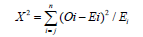
Where X2=Calculated Value
O=Observed frequency
E=Expected frequency
From the table above equation, the expected frequency was calculated using the formula;
E=Σf/n,
Where E=Expected Frequency
F=Frequency
n=Number of Categories
The degree of freedom (d.f)=n-1
Where n=Number of categories
Table 2 Shows the relationship between agricultural land use and residential land use in Ipinsa where the degree of freedom is 1 (that is, 2-1), and the value from chi-square table at 5% (0.05) level of significance was 3.84 which was less than the calculated value (X2=746.5), therefore, H0 is rejected is rejected. It can therefore be concluded that there is a significant relationship between agricultural practice and residential land use in Ipinsa. From the above table, the degree of freedom is 1 (that is, 2-1), and the value from chi-square table at 5% (0.05) level of significance was 3.84 that was less than the calculated value (X2=746.5), therefore, H0 is rejected is while Hi is accepted. Thus, it was revealed that the percentage of agricultural land use in Ipinsa is greater that the percentage of residential land uses (Table 3). In the above table (Table 4), the degree of freedom is 2 (that is 3-1), and the value 2 on the chi-square table at 5% (0.05) level of significance was 5.99 that is lesser to the calculated value (X2=37.36), therefore, H0 is rejected while Hi is accepted. Thus, agricultural practice has impacts on housing condition.
Table 2:Relationship between agricultural land use and residential land use.

Table 3:Percentage of agricultural land use to residential land use.

Table 4:Chi-Square table showing the impact of agricultural practice on housing condition.

Summary of Findings
This research has revealed that Ipinsa community is endowed with a fertile land capable of accommodating series of the agricultural practice if it is well used and provided with the proper infrastructural facilities needed. These facilities include; good transportation system (road), water resources, electricity, etc. This research also revealed that much has not been realized from the agricultural practice as expected to be, this is associated with the use of crude instruments (hoes and cutlasses) in carrying out farm activities, practicing of subsistence type of agriculture by some farmers in the community, poor transportation system, inadequate government support, lack of technological application, inadequate educational facilities, inadequate preservatives facilities, etc. From the analysis of data collected during this research, it could be deduced that there are no rules and regulations binding the use of land in the community and that the majority of the residents are farmers (male and female). Also, the community is served with only a major road (i.e. old Ibadan-Onitsha express road) which is in poor state, which left the farmers with no option than to use motor cycle popularly known as Okada or foot in transporting their produce to the market. Some other major concern of the residents is inadequate government support in agricultural production, and shortage of fund to enhance production which resulted in: low production and limited market as their produce is being sold to individuals rather than companies or group of buyers (Figure 11).
Figure 11:Impact of agricultural practice on housing condition.

Figure 12:a. Livestock being rear in residential neighborhood, b. Livestock being rear in residential environment.

As a result, there is need for construction of roads and improvement on the existing ones to encourage agricultural activities in the community. The study further shows that agricultural activities lacks recent innovative technologies where the forest reserves are exploited manually and bush burning cultivating system is being practiced which has brought the practice up with some environmental effects especially on the residents such as soil erosion, air pollution, noise pollution, poor sanitation (due to animal rearing), etc. Thus, causes misunderstanding between residents. Therefore, it can be concluded that agricultural practice in Ipinsa community is primitive with regards to modern technologies, infrastructural facilities, technological knowhow, etc and has caused a lot of effects on the environment (Figure 12).
Conclusion
Agriculture offers outstanding opportunities for enhanced economic prosperity at National, State, Local and personal income levels respectively. In spites of the effort of the government of Nigeria towards enhancement of Agricultural production as well as enhancement of sustainable development in our society, the sector still has some short falls which affect other sectors through various activities involved as we have in the case of agricultural practices in residential neighborhood. Though, there has been consensus of opinions among the professionals (especially the planners), stakeholders, and policy makers on how to stop, control or reduce the advert effects in our neighborhood and to the nation as a whole.
The impact on local communities can be positive or negative, whether it comes to economic or environmental effect. It depends on the extent or method of agricultural practice in a community. There is no doubt that government will continue to play an active role in the agricultural sector of any nation as it solely requires adequate funding, effective management, technological innovation, transportation and communication. Therefore, with careful planning, adequate support, adequate publicity given on the effect of agricultural practices on residential land use in Ipinsa community, the negative effects on the community dwellers will reduce drastically and so, environmental degradation will be controlled.
Recommendation
From the study, the researcher arrived at certain findings which need to be addressed because some of these findings have negative effect on the residence of Ipinsa. The following are some of the recommendation of the study.
Environmental sustainability
Deforestation was one of the factors that lead to degradation of the environment, thus, some deforestation practices have been started in Ipinsa. The ministry of agriculture every year emphasizes on the need to plant trees. In this situation, sites to carry out the exercise are usually selected. However, they do not usually go beyond this ceremonial launching of trees planting because they do not make much effort to sustain the culture of tree planting on the environment. It is therefore important for the ministry to officially pursue this laudable exercise in Ipinsa sustaining this habit on people to call for environmental sustainability of the community.
Zoning
It was revealed that mixed land use is being practice in Ipinsa (especially residential and agriculture), this implies that there is no organ of government that is vested with the responsibility of determining how land is to be used for such purpose that may be detrimental to the environment. A body should exist to plan the land use in Ipinsa. Zoning laws should be operated in order to determine the use certain land should be put.
Improve transportation
As it was revealed during the research on this paper that the only road present in Ipinsa has being in existence since 1950 during Awolowo’s regime and it is even in a bad state. There is therefore need of construction of new roads and improvement on the existing one for easy transportation of the agricultural products to the market as well as smooth movement of the resident in Ipinsa by the government.
Technological innovation
Mechanical exploitation of agricultural product should be encouraged instead of the manual exploitation system used. This can be done through the introduction of necessary and adequate machines for agricultural practice by the government to the farmers in the community as a means of support and to make the production a large-scale produce.
Agricultural input
Government should endeavor to supply the farmers with subsidized agricultural inputs such as fertilizer as a means of government support to the sector to provide for enough food for the community and ensure the safety of the food production.
Education/Awareness
Education should be provided to the farmers to notate them the negative impacts of some agricultural practice in our environment such as deforestation, bush burning, etc. This will allow them to know the implications of these activities and control them if not stop them.
Some of these recommendations when they are addressed would help to ameliorate the effect of agricultural practice on residential land use in Ipinsa and equally help to reduce the impact of environmental degradation in other communities facing similar problem.
References
- National Open University of Nigeria, NOUN (2009) General Agriculture, Nigeria.
- Food and Agriculture Organization FAO corporate document (2007) Produced by economic and social development department. The State of Food and Agriculture, Nigeria.
- United State Development Agency USDA (2002) Major uses of land in the United States. Economic Research Service/USDA.
- Breman H (2006) Improving african food security. Ijaerd Press, Nigeria.
- Food and Agricultural Organization FAO (2009) Food security and agricultural mitigation in developing countries, Options for Capturing Synergies, Nigeria.
- Obateru IO (2003) Land subdivision basics. Pent House Publish, Nigeria.
- Cassman KG, Wood S (2005) Sustainable Agriculture, Nigeria.
- Defries, Foley, Bartlett J, Rehm G (2004) Fertilizing cropland with poultry manure, Nigeria.
- Foley, Schmitt Rehm (2005) Trading Economics, Nigeria.
- Akinbode T (2006) Impact of population pressure on agricultural land use. Unpublished Honour’s thesis, Bsc. Ambrose Alli University, EdoState, Nigeria.
- ZHOU Tao, Ying L, Ping L (2007) Residential Land Use in Urban Fringes. Tiptopylobe Ltd, p. 18.
- Burgees EW (1925) The Growth of The City: An Introduction to A Research Project’ Publication of the American Sociological Society, pp. 85-97.
- Fabiye Oluseyi O (2006) Urban land use change analysis of a traditional city. Idosi publishers, Dubai, p. 52.
- Jiboye AP (2005) Globalization and the urban growth process in Nigeria. In: Fadare Globalization, Culture and Nigerian Built Environment. Faculty of Environmental Design and management, OAU, Ile-Ife, Nigeria 2: 342-345.
- National Population Commission NPC (2006) Census 2006 Final Result, Ondo State, Nigeria.
- Besplatnye IO, Bukljaru, CZ Inzerce (2012) City (Town) Map, Population, Nigeria, Tiptoglobe.com.
- Kothari CR (2009) Research Methodology, Methods and Techniques (2nd edn), Age International Publishers, New Delhi, India, p. 56.
- Aribigbola A (2008) Improving urban land use planning and management in Nigeria. Alpha Print Ltd, Nigeria.
- Aribigbola A (2008) Planning and sustainable development: Innovations and new directions for the built environment in Nigeria, p.185.
- Cassman KG, Maston PA, Naglor R, Polashy S (2002) Agricultural sustainability and intensive production practices. International Journal of Science 418: 671-677.
- Congress Study (2004) In encyclopaedia Britannica. Form Encyclopaedia Britannica.
- Chrispeels DE, Sadavap MJ (1994) Farming system; development, productivity and sustainability in plants, genes and agriculture. Mcgraw & hill Publishers, p. 25.
- Dillipchandra (2012) Types of Agriculture, Nigeria.
- Dickson AO (2004) Regional study on agricultural support, Nigeria.
- Economic Community of West Africa State, ECOWAS (1995) Part 4 further paper on overcrowding agricultural water pollution in the European Union.
- Encyclopaedia of the Nations (2012) Economy of Nigeria. From Encyclopædia Britannica.
- Famariyo (2007) Land Tenure and Agricultural Development. Jamoe Enterprises, Nigeria, p. 12.
- Harris CD, Ullman EL (1945) The nature of cities; The Annals of American Academy of Political and Social Science, pp. 7-17.
- Homer H (1933) The structure of growth of residential neighborhoods in American cities. Federal Housing Administration, Washington, USA.
- Igbozurike UM 1978) An evaluation of the impact of land fragmentation on agricultural productivity. Regional Conference of International Geographical Union, Lagos, Nigeria, 1: 95.
- Jared WS (2005) Environmental studies senior, seminar research project on agricultural type, Nigeria.
- Jiang (2001) Economy of Nigeria, Nigeria.
- Junge B, Robert A, David C, Kahl S, Rattan L (2008) Soil conservation in Nigeria; past and present on-station and on- farm initiatives. International Institutes of Tropical Agriculture, Ibadan, Nigeria, p. 13.
- Kellerman DF (1999) New webstar’s dictionary of the english language. Delair Publishing Company, New York, USA.
- Ministry Of Physical, Urban And Regional Planning, Ondo State, Nigeria.
- Ofometa GEK (2001) Geographical perspectives on environmental problems and management in Nigeria. Jamoe Enterprises, Nigeria. p.14.
- Oxford Dictionary of Current English (3rd edn), Oxford University Press, UK.
- Pielke RA (2005) Land Use and Climate Change. Journal of Science 310(9): 1625-1626.
- Swaminathan MS (1995) Population, Environment and Food Security. CGIAR Issues in Agriculture 7. CGIAR Publishers, Washington, USA.
- Tilman, Cassman, Maston, (2007) Land cover
- Rome (2008) United Nation Food and Agriculture Organization, UNFAO.
- United Nation Food and Agriculture Organization UNFAO (2006) Livestock A Major Threat to Environment, Italy.
- United State Development Agency USDA (2005) Guiding principles for sustainable development, USA.
- Yudelman, John Mc Conell D (1989) The forest garden farms of kandy. Sir Lanka P.I’ ISBN Ltd, p. 27.
- Zhoutao (2007) BesplatnyeIgry Onlajn, Buklja Ru Cz Inzerce (2012) Navigate map of the whole world. Tiptopylobe Ltd p. 2.
© 2018Owolabi Babatunde Oluwaseyi. This is an open access article distributed under the terms of the Creative Commons Attribution License , which permits unrestricted use, distribution, and build upon your work non-commercially.
Editor In Chief


.jpg)


Signup for Newsletter

Quick Links
 Editorial Board Registrations
 Submit your Article
 Refer a Friend
 Advertise With Us
Our Recent Edition

.jpg)


Top Editors


.jpg)


.bmp)
.jpg)
.png)
.jpg)


.jpg)


.png)

.png)


.png)


Financial Support

Sponsors

Latest e-Books

Latest Video

 a Creative Commons Attribution 4.0 International License. Based on a work at www.crimsonpublishers.com.
Best viewed in
a Creative Commons Attribution 4.0 International License. Based on a work at www.crimsonpublishers.com.
Best viewed in