- Submissions

Full Text
Environmental Analysis & Ecology Studies
Hegemonic Attitude Blocks Fair Sharing of Transboundary Water Issue
Miah Muhammad Adel*
Professor of Physics, Astronomy, University of Arkansas, USA
*Corresponding author: Miah Muhammad Adel, Professor of Physics, Astronomy, Water and Environmental Sciences, University of Arkansas at Pine Bluff, USA, AR 71601
Submission: January 05, 2018; Published: February 20, 2018

ISSN: 2578-0336 Volume1 Issue2
Abstract
India and Bangladesh are, respectively, the upstream and the downstream riparian countries of the Ganges Teesta Brahmaputra Meghna river system. Bangladesh acts as the outlet of their water discharges. India has built a unique ring of dams and barrages along the border of the two countries on more than 50% of the 58 common rivers to let out the flood season water that she fails to accommodate and to stop flow the lean season water. Also, she has built dams on nearly all the tributaries of the Ganges. Bangladesh presented a plan to India on building reservoirs in Nepal to solve the water shortage problems and have other benefits. But India was adamant that she was not going to bring Nepal to solve the water problem. Rather, she prepared an accounting of Bangladesh's water need based on the population and areas in the Ganges Padma, the Brahmaputra Jamuna, and the Surma Meghna River sub basins which would be subversive to the ecosystems if Bangladesh had accepted.
India went with her hegemonic attitude and deprived Bangladesh of her due share of the Ganges water just to build India's #1 National Waterway for inland cruising. The loss of the surface water resources along with over extraction of the groundwater to overcome the need, has turned the north and northwester parts of Bangladesh water scarce triggering a domino effect on inland waterways, people's livelihoods and nutritional intakes, transportation, water contamination, climate, and so on. Many distributaries have died and the depths in the main rivers have been shallowed causing widespread flooding as India releases the gates of dams and barrages being unable to accommodate the flood water Bangladesh's demoralized polarized politician's trade off political gains with outsourcing of national resources since they lack the courage of raising the genuine case of upstream water piracy caused national sufferings to the international court of justice. Some intellectuals and diplomats support their activities for personal benefits. India's united politicians use their words of water sharing as ploys to buy time to let Bangladesh's rivers silted, in which case people in overpopulated Bangladesh will grab silted river beds and Bangladesh will not ask for water lest people's residences will inundate. Nations, however powerful, should stop playing with water resources in the name of management to let it stay in the virgin state to save the planet from frequent anthropogenic disasters like climate change, flooding, etc.
Project site: The project site is Bangladesh located at 24°00'N and 90°00'E. The principal rivers of Bangladesh shown in are the Ganges (Padma in Bangladesh), the Brahmaputra (Jamuna in Bangladesh), the Teesta, and the Meghna. The Teesta is the major tributary of the Brahmaputra, and the Meghna's headstreams are the Surma and the Kushyara generated by the bifurcation of the Indian Barak River The Teesta flowing from Sikkim joins the Brahmaputra as a tributary. The Brahmaputra joins the Padma as a huge tributary. Also, the Meghna joins the Padma as another tributary by definition. Indian and Bangladesh are riparian countries of these rivers. For the survivability of the downstream Bangladesh ecosystem, the maintenance of a minimum dry season discharge is required in these rivers which can be assured by India.
Keywords: Hydropopwer; Green revolution; Political polarization; Transboundary rivers
Introduction
Upstream India has set up dams and barrages on more than half of the 58 Indo Bangladseh common rivers (Figure 1). As of the eighties of the last century, these dams have been on the Isamati Kalindi, the Betna Kodalia, the Bhairab Kabodak, the Ganges, the Khukshi, the Atrai, the Punarbhaba, the Mahananda, the Karotoa, the Talma, the Ghoramara, the Dewani Jamuneshwari, the Buri Tista, the Tista, the Sangil, the Dharla, the Jinjiram, the Bhogai, the Piyan, the Kushiyara, the Sonai Bardal, the Juri, the Manu, the Dhalai, the Khowai, the Sonai, the Gomti, the Selonia, the Muhuri, and the Feni (Figure 2). More upstream water piracy constructions are being proposed and built. Some of these rivers (viz. the Ganges, the Mahananda, etc) have multiple dams at the upstream. These dams are used to pirate the dry season downstream flow from Bangladesh and release flood water during the wet season to flood Bangladesh whose river beds are silted due to Indian weakening of river discharges by construction of dams and barrages.
Indian hegemonic attitude toward Bangladesh since her birth in 1971 has created unsurmountable recurrent problems. India constructed the Bangladesh's death trap Farakka Barrage on the Ganges to set up her No. 1 National Waterway for inland commercial cruise travel by pirating Bangladesh ecosystem's water. She broke the treaty of the 41 day test run of the Barrage. Now she claims of having changed the course of the Ganges through her territory. On top of this, India pirates the Teesta River discharge. She has built the Great Ring of Dams around Bangladesh upon about half of the 58 international rivers between the two countries. Bangladesh gave the option of reservoir construction in Nepal to meet the water demand of the two countries. India never wanted to make Nepal a partner in solving the water problem. She proposed to excavate a canal through Bangladesh to take a part of the Brahmaputra discharge to the Ganges to augment the Ganges discharge.
Figure 1: The political map of Bangladesh.

Figure 2: The political map of Bangladesh.

The canal would cause a lot of problems for Bangladesh besides letting India control discharge of both the Ganges and the Brahmaputra. The dammed rivers have got silted beds within Bangladesh reducing their water accommodation and discharge capacities by more than 75%. Out of 794 million tons of Ganges sediment consisting of particles less than 0.00195mm in diameter, and coarse sand reaching up only to 1.5mm in diameter [1], Indian inland gets 65 million tons, Bangladesh inland 328million tons, Indian coast 361 million tons and Bangladesh coast 65 million tons. Similar should be the distribution of the Brahmaputra's annual sediment which about 527 million tons. Riverine Bangladesh has lost thousands of km of inland waterways. Waterlessness in Bangladesh causes summertime temperature unbearably high and the wintertime temperature unbearably cold that takes a heavy toll of lives upon infants and at risk population. India fails to contain flood causing monsoon season rainfalls within her Her opening of the dam and barrage gates multiple times floods Bangladesh multiple times in the same year.
The floods cause irreparable losses of lives and properties to Bangladesh. Bangladesh faces double trouble when rainfalls cause flashfloods there because of drainage problems. India, too, faces floods because the dammed rives cause siltation at their upstream, too. Additionally, India tries to engulf Bangladesh by tactfully demanding a diagonal route through the overpopulated Bangladesh to reach her eastern states to control their independence struggle maintaining negligence over developing routes to reach the eastern states through her bottle neck territory in the north. Bangladesh failed to receive her due share of river discharges even in exchange of granting India transit rights through Bangladesh and Bangladesh seaport use rights. Bangladesh has become a prey to never ending Indian greed. Rivers have to be excavated and dams have to be demolished to render rivers to back to their virgin states. Hegemonic attitudes may breed struggling animosity among the subjugated nation. This article presents all these issues (Figure 1).
Methodology
The dammed primary, secondary, tertiary, quaternary, quinary, and senary tributaries of the Ganges and the Hooghly have been found. The Indian constructions of the Great Ring of Dams and Barrages surrounding Bangladesh have been shown. The Indian tricks of her setting up the National Waterway # 1under the pretext of making her own action caused innavigable Hooghly navigable through the construction of the Death Trap Farakka Barrage upon the Ganges has been reviewed. The Indian request to make the 41 day testrun of the Death Trap and her achieving the distrust for continuing indefinitely beyond the 41 day has been mentioned. Bangladesh's raising the Indian water piracy issue to the United Nations followed by signing a water piracy treaty and the henious comments in Indian press has been discssed. The Indian proposal of diverting water from the Brahmaputra to the Ganges and the counter proposal of Bangladesh of making Nepal a party in solving the water issue with the constructions of reservoirs in Nepal has been deliberated.
The 30 year water piracy issue with its multiple times breakage by India has been explored. Indian weapons of dams and barrages to stop discharges through Bangladesh and rainy season floods in silted river beds because of decades of obstructions to normal discharges has been described pictorially. Obstructions to normal discharge caused silting upstream, too, and caused flooding in some Indian upstream states. Bangladesh’s loss of thousands of kilometers of of inland waterways hjas been presented. The issue of climatic changes making rainfalls erratic and summer and winter temperatures unbearable has been pointed. It was observed that Bangladesh's massive use of groundwater in the absence of surface water has been turmed "green revolution" by some superficial economists just because of farming both crops and fish together ignoring the fact that groundwater is on the verge of depletion somre signs of which have been found in the appearances of cracks in, sinking of, and collapse of buildings in the capital city Dhaka. India is planning to divert flood season water to her drought prone parts which will deprive Bangladesh flood seaso discharge, too.
Dams and barrages upon the Ganges's and Hooghly's tributaries
Figure 3(a): Tributaries of the River Hooghly. Only a few dam/barrages have been shown (Niyogi, 2008).
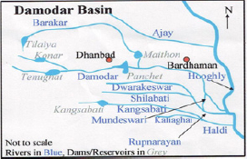
Figure 3(b): The Feeder Canal (Photo credit: Prasad, reproduced with permission). The dry season pirated water from the Gangetic Bangladesh�s ecosystem provides navigability and adds aesthetic beauty.
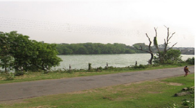
India dammed almost all of t of the world's 8th largest River Ganges and the tributary abundant river Hooghly which is linked to the Ganges by a seasonal canal like offshoot called the Bhagirathi (Figure 3a & 3b). In the absence of the timely discharges from its dammed tributaries, the Hooghly was dwindling. Also, India built the Farakka Barrage upon the Ganges (Figure 4a) itself with the multiple purposes of cornering Bangladesh in case of the latter's disobediency, and claimed of having changed the course of the Ganges to set up the nation's water way # 1 The barrage is located near the head of the Bhagirathi, the seasonal upstream part of the Hooghly (Figure 4b). She excavated the Feeder Canal along the Bhagirathi's bed to turn it into a perennial source of water to connect the Ganges and the Hooghly (Figure 4c). Thus, India tactfully paved the way to demand from ever grateful Bangladesh her ecosystem's water to keep the Hooghly navigable. (Table 1 and Figure 5).
Figure 4(a): Farakka Barrage (Courtesy of SANDRP).

Figure 4(b): The head of the Feeder Canal to turn the seasonal off-shoot Bhagirathi into the perennial Feeder Canal).
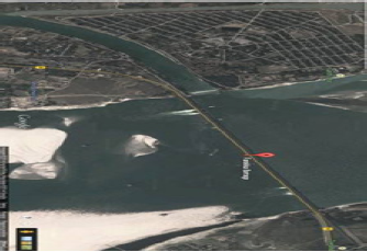
Figure 4(c): The construction at the Feeder Canal head (Reproduced with permission from SANDRP).
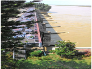
Figure 5: The Indian National Waterway No. 1
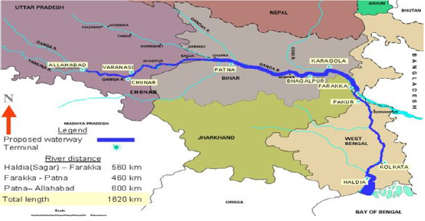
Table 1: Tributaries of the world’s 8th largest River Ganges.

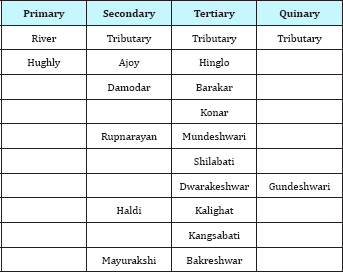
Constructions of dams and barrages extend from the the main rivers to its remotest tributaries of the Ganges (Table 2 and Figure 3) In her inch by inch approach to change course of the Ganges, India first persuaded the Bangladeshi Premier to sign in a communique that the Ganges water was not enough for both India and Bangladesh whereas the giant river has founded, nourished, and maintained its riparian flora and fauna from the higher Himalayas to the coast of the Bay of Bengal [2-4].
Table 2: Some of the Dammed Tributaries and Sub-tributaries of the Hughly River.
Indian breakage of the test run and other water piracy treaty
Later, India made and broke the initial 41 day test run agreement of the Farakka Barrage in April May 1975, and continued water piracy till the end of 1977 when a 5 year treaty which can be termed a forced consent to piracy right, in return of some namesake discharge through Bangladesh, was signed after Bangladesh's raising the issue to the UN General Assembly. These prompted Indian dailies' heinous comments against Bangladesh, unveiling Indian mean attitude to deal with neighbors [5]. Later, two memoranda of understanding were signed by the two governments in 1982 and 1985 to grant India the piracy right. India’s piracy continued from 1988 through 1996 at the end of which a 30 year forced consent was given by Bangladesh.
According to the latest piracy right given to India, the left over discharge through Bangladesh on 27 March 1997 was to be 976.93cum/s, but the discharge through Bangladesh was only 184.06cum/s (less than one fifth according to the treaty). The Indian Ganges water piracy of such lion's shares is of regular occurrences which have turned the treaty a baloney. If more than 70% water of an ecosystem's founding and sustaining water is depleted, existing reasonable uses lose its meaning [5]. During the entire dry season (January May) of 1976, India pirated the largest amount of water from the Ganges. This is the record of human rights for a potential permanent member of the Security Council of the UNO. In that year 75% of the Gangetic ecosystem's water was pirated by India.
A nation so developed in science and technology and so resourceful that sends a voyager to Mars and has successfully made a heavy rocket lifting device and that has set up an international water research institute and observes the World Water Day, should have at her finger's end the knowledge on the curses of 75% water piracy from an ecosystem. Later, in between short term water sharing treaties India unilaterally pirated the dry season Ganges water to the extent of more than 70% for indefinite intervals, to corner Bangladesh lest she disagrees to the India’s absurd demand of diverting the Brahmaputra discharge via a link canal through the northern part of Bangladesh at the upstream of the Farakka Barrage to have enough water there for release into the Bangladesh Ganges.
Indian proposal
The Indian proposed 337km long, 805m wide, and 9.14m deep link canal would originate in Assam State, India, and would enter northern Bangladesh at an elevation of 31m, then rise to an elevation of 40m at the mid section before dropping down (Figure 6a). To raise water at the higher elevation at the mid section, India proposed to build a large barrage on the Brahmaputra at Goalpara in the district of Goalpara in Assam. About one third length of the canal i. e, 112km will go through Bangladesh.
Figure 6(a): The Brahmaputra Basin in Bangladesh. The link canal originating from Assam would pass over a number of streams even if it was going along the 26o parallel.
The link canal was going to have some major subversive effects for Bangladesh. The canal was going to separate the greater northern districts of Rangpur and Dinajpur from the Bangladesh territory. One million people were going to be displaced. Millions of dollars would be required to rehabilitate the displaced ones. Bangladesh government would have to acquire 12,000ha fertile land for digging the canal. The loss of this agricultural land would entail Bangladesh government a loss of annual food production of almost 17billion of Bangladeshi currencies according to the cost estimate of the seventies. The link canal was going to cross 11 rivers the Teesta, the Dharla, the Ghaghot, the Burikhora Chiklee, the Korotoa, the Dewani Jamuneshwari, the Soto Jamuna, the Atrai, the Punarbhaba, the Tangon, the Mahananda, and a few small streams of Bangladesh (Figure 6b).
Most importantly, the construction of the barrage in Assam would transfer the physical control of another major river into India's hands. India's track record of the Farakka Barrage disqualified her for this proposal. Finally, the lowest recorded flow of the Brahmaputra being only 3,117cumecs, the piracy of 2,832cumecs as proposed by India would leave only 285cumecs for the 13km wide river. This is too little for fulfilling the needs of Assam and Bangladesh.
Figure 6(b): Index Map of the Teesta Project. Tessta Basin (Niyogi 2007).

Further, the greater Rangpur and Dinajpur Districts would be separated by the Link Canal, a potential trick to change the map of Bangladesh. There are instances where India occupied charlands (islands in rivers) formed by the erosion of the Bangladesh side river banks, within the Bangladesh river beds, following Indian construction of groynes. These are, notably, the Isamati Kalindi River, the Kushiyara River, Muhari River, and other border rivers. Agricultural land belonging to 50 rural areas (villages) from Kaliganj, Shyamnagar, Kalaroa, Dehata, and Satkheera Upojila went into the river. India occupied the shoals formed with the eroded soil. Indian Land Survey Department showed them as parts of India. India built a groyen on their side of the Kushiyara River that borders with India on the south side of the Zakiganj Upozila. The river has been caving into Bangladesh. Shoals formed on the Bangladesh part of the river bed were occupied by India. The center of Zakigang town had been engulfed by the river and India occupied that. The lost places in the river are, to name a few, Amalseed, Maniqpur, Shaheed bag, Pinnakandi, Amalnagar, etc.
Bangladesh's cooperative proposal
Bangladesh proposed an integrated basin development plan with the cooperation of the riparian countries - India, Nepal, and Bangladesh. Their joint venture could annually generate 550,0 million cu m surface water in the Ganges basin. The most important component of the annual production was the increase of the dry season discharge. Bangladesh proposed construction of seven dams in Nepal on the rivers
a) The Chisapani (the dam height 265m, the dammed discharge 1546cumecs, the natural discharge of 1977cumecs)
b) The Kaligandaki 1 (the dam height 102m, the dammed discharge 380cumecs, the natural discharge of 482cumecs)
c) The Kaligandaki 2
d) The TTisulganga (the dam height 284m, the dammed discharge 1055cumecs, the natural discharge of 1305cumecs)
e) The Seti (the dam height 180m, the dammed discharge 192cumecs, the natural discharge 246cumecs)
f) The Sapta Kosi (the dam height 327m, the dammed discharge of 1,943cumecs, the natural discharge 2,411cumecs) and
g) The Pancheswar (the dam height 140m, the dammed discharge 223cumecs, the natural discharge 363cumecs) to get the major contribution of 70,000 million cu m toward increasing the existing dry season flow of the Ganges to meet estimated 189,700 million cum for the three countries (Figure 7). Another source of the dry season Ganges discharge augmentation was the India's planned 51 storage dams to provide 63,000 million cum. Out of the 51 planned dams, the completed 29 dams were already providing 30,000 million cu m. Also, India had been utilizing 36,500 million cu m of water in different irrigation projects. These 70,0 million cu m from Bangladesh’s proposal of reservoir building in Nepal, 63,000 million cu m from India's planned storage dams, and 36,500 million cu m along with about 26,000 dry season availability exceeds the estimated 189,700 million cu million cu m that Farakka receives during the dry season, the total m by 5,800 million cu m.
Figure 7: Locations of the proposed seven dams in Nepal.

Following the devastating floods in 1987 and 1988, a Nepalese Bangladeshi team conducted a joint study that recommended 30 potential reservoir sites in Nepal for the purpose of flood control, dry season discharge generation and hydropopwer production. Out of the 30 recommended reservoir sites, discharge regulation wise the more promising ones were the Saptakosi, the Tamur I, the Sun Kosi II, the Buri Gandaki, the Marsuyangdi, the Seti -I central, the Kaligandaki I, the Kaligandaki II, the Andhi Khola, the Mainachuli, the Bagmati, the Bhalubang, the Naumuri, the Pancheswar, and all the Karnali basin reservoirs. The December through May discharge augmentation potential was estimated to be 4,950 cumecs, and the hydroelectricity 36,600MW (Figure 7).
India's accounting in the link canal proposal
Figure 8: The Ganges basin in Bangladesh.
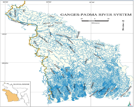
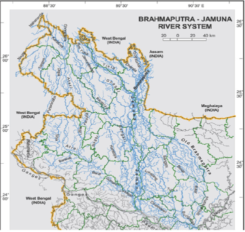
Figure 9: Brahmaputra-Jamuna subbasin.

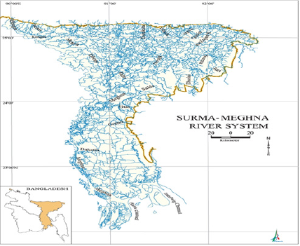
India put forward that the Ganges sub basin (Figure 8) covers a geographical area of 1,076,000sq km with 65.3mha cultivable land, 38.0mha m annual average runoff for a population of 30.3 million. She put forward that the Brahmaputra sub basin (Figure 9) covers a geographical area of 582,000sq km with 9.2 mha cultivable land, 62.6mha m annual average runoff for a population of 59 million. And for the Meghna sub basin (Figure 10), she put forward a geographical area of88,000sq km with 4.5mha cultivable land, 14.36mha m annual average runoff for a population of 32 million. India argued that she needed about 9,061cumecs in rabi and 5,663cumecs in summer. Further, she needed 1,133cumecs for Calcutta port. Furthermore, there was the need for water for the drought prone and water deficient areas. India said that the total potential storage in India would not exceed 50 billion cu m and that in Nepal would not exceed 700cumecs
Figure 10: The Surma-Meghna river basin, the tail part of the Barak River.
Impacts Upon Bangladesh
Erratic rainfalls
Figure 11: Erratic rainfalls in the Ganges basin (Rajshahi).
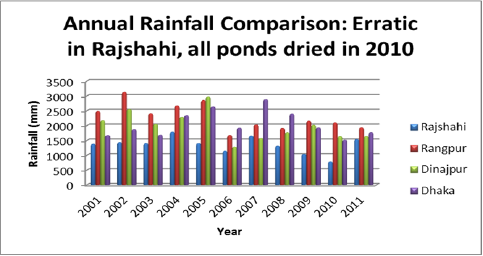
With the depletion of the surface water resources, rainfall has become erratic (Figure 11) shows the variation of rainfalls in the first decade of this century in the Rajshahi region of the Ganges basin. In 2010, even the deepest ponds dried out. Frequencies of heavy rainfalls have decreased to about 50% but there has been an increase of drizzles. No weeks long rainy days of the pre piracy period are observed. All it shows that India's accounting of the average run offs in different river basins needs to be reaccounted for. Since water begets water, upstream water piracy does not anymore favor downstream downpours.
Navigability loss due to water piracy
Table 3: Navighability Loss in Bangladesh.
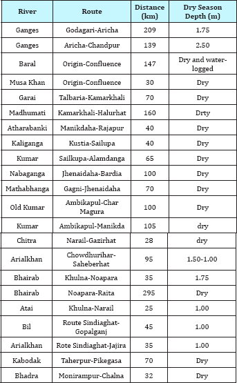
Bangladesh lost a huge expanse of inland navigability. It is to be noted that transportation on water ways are a few times cheaper than that on the land (Table 3).
Table 4: Downstream Lost Waterways (BITWA, 2014).
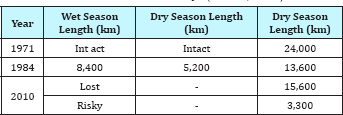
Courtesy: BIWTA Bangladesh Inland Water Transport Authority (slightly modified by inclusion of the left over rivers from the northern part) (Table 4).
People's climatic severity feelings
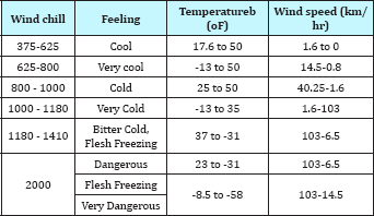
Climate has turned extreme. Every year in summer and winter fatilities occur due to the climatic severity. The tables below shows the climatic severity data (Table 5-9) .
Table 5: People's feeling under different temperature and humidity values.
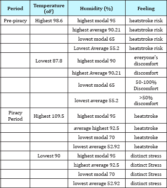
Table 6: People's feelings in pre- and ongoing-piracy periods of increased humidity.
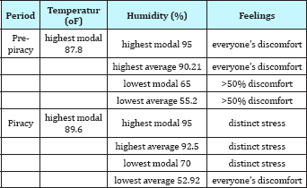
Table 7: Wind Chill Index
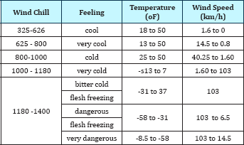
Table 8: People's feeling under pre- and on-going piracy periods of increased humidity.
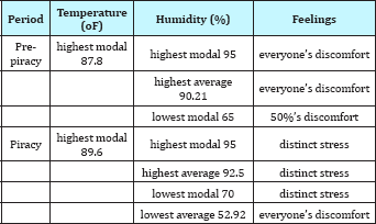
Table 9: Wind chill index.
Intellectual Polarization
Figure 12: Massive groundwater withdrawal to flood rice fields.
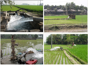
One class of economists in Bangladesh are just supporters of the government. Another class follows unholistic approach in their research. The first class of economists praises the government. They do not speak the truth. They are run by personal interersts. The second class of economists, too, portray a wrong picture of the country. They do research on superficial things to increase their publications in their vitae. These economists [6-10]are giving a wrong picture of the country at home and abroad. In the absence of surface water, farmers use groundwater for rice cultivation along which they raise fish (Figure 12). Economists call it a green revolution and writing articles after articles on removing poverty through simultaneous double cropping -rice and fish. Almost 50% of the water raised evaoporates and another 50% infiltrates into the ground. It takes hundreds to thousands of years to build groundwater.
Through our "green revolution", Bangladesh is losing the last resort. Water is so scarce a commodity that cannot be bought, and these economists call the farmers' exhausting of this commodity a green revolution. The essentiality of the importance of natural renewable resource is ignored. The GDP economists cannot show this in their improved calculation of GDP because the deterioration or scarcity of natural resources does not enter in the GDP formula although the production depends on the natural resources. Historically speaking, the GDP idea was introduced when no countries of the world were pirating or had the idea of piracy of the renewable natural resource of another country - not even the colonial powers.
India's wet season water piracy
Figure 13: Erratic rainfalls in the Ganges basin (Rajshahi)
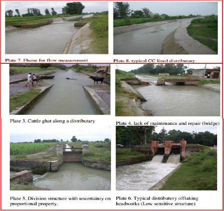
What India is planning now is to pirate the wet season Ganges water. In the upper reaches of the Ganges, there are the Upper Ganges Canals (total length 6582.22km), the Madhya Ganges Canals will use the monsoon season excess water of the Ganges for cultivating 64,000ha paddy in dry pockets within the Upper Ganges Canal area. Also, it will develop paddy cultivation in 114,000ha in the command area under the Upper Ganges Canal (Figure 13), and the Eastern Ganges Canals (a CCA of 2333,000ha and an irrigation potential of 105,000nha) is meant to use the monsoon season excess water from the Ganges for irrigation Bijnor and Moradabad districts of Uttar Pradesh. The canal network's, the total length is 203.09km. The Lower Ganga Canal consists of a 1,158m long weir across Ganga at Narora to raise the winter Ganges discharge by 3.05m to be fed into the canal that emerges from the right bank of the river.
It irrigates 0.5million ha in the districts of Mainpuri, Etah, Farrukhabad, Etawah, Kanpur, Fatchpur, and Allahabad in Uttar Pradesh. The Main Canal and branches in the Lower Ganges Canal measure about 1,060km, and distributaries 5,015km. The combined service of the Upper and the Lower Ganges Canals form the world’s largest irrigation system - no less than 12,240km long to irrigate an area of 1million ha. Hillary, a traveller on the Ganges, reports that during the dry season almost all the water is taken by India at Hardwar (1979).
Teesta water sharing
The Teesta water piracy is shown in (Table 10) below Source: Hydrology department, Rangpur. Before the Indian Teesta water piracy started by the Gajaldoba Barrage, the Teesta's dry season flow would remain within 170-283cumecs. And after the construction of the barrage, the discharge dropped to 85cumecs. The recent worst year of 2014 discharge has been shown in (Table 10) above. Surface water shortage caused a shortage of recharging water - 8m deep tubewells failed to extract groundwater. About 9million people in 5,500 villages in 35 upozilas of the districts of Qurigram, Lalmonirhat, Nilphamari, and Rangpur became victims of water scarcity in the Teesta. Indian water piracy has lost the balance in the sectors of employment, agriculture, industries, and in nature. The Mahananda Barrage controls 15 rivers in northern Bangladesh. These are the Mahananda (Bangladesh part), the Korotoa, the Teesta, the Valuka, the Ranchandi, the Talma, the Ghoramara, the Buriteesta, the Versa, the Chilak, the Balam, the Pisla, the Dahuk, the Chawai, and the Qurum (Figure 6).
Table 10: Teesta Water Piracy.

Figure 14(a): Teesta woes for farmers. Pinaky Roy, 14 April 2014.
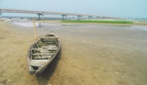
Figure 14(b): Silted and dry bed of Teesta Pankaj Karmakar, 24 April 2014.
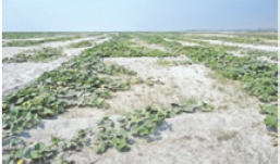
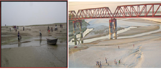
(Figure 14a-14c) (all three insets) and (Figure 15a-15c) (first two insets from the left) show the dire conditions in north western Bangladesh including the dry bed of the Teesta, dry canals, etc. because of Indian water piracy using the Teesta Barrage. The Nilphamari, Thakur Gaon, Rangpur, Dinajpur, Joypurhat, Naogaon, Nawabganj, Rajshahi, Bogra, Sirajganj, Pabna, Kustia, Meherpur, Chuadanga, Jhenaidah, Magura, Rajbari, Faridpur, Jessore, Narail, Gopalganj, Madaripur, Shariatpur, Satkhira, Khulna, Bagerhut, Pirojpur, Jhalkathi, Patuakhali, Barguna, Barishal, Bhola, Jamalpur, Tangail, Manikganj, Dhaka, Gajipur, Munsiganj, Chandpur, and Lakshipur (Figure 1). Apart from irrigating about 0.922ha lands in six districts of West Bengal, the project supports 67.50MW generation using the three water falls on the Mahananda main canal. Also, navigation and flood control is supported by the project. (Figure 16a & 16b) shows the dry bed of the Ganges (Padma) by Rajshahi City and the Ganges's distributary the Garhai River which is the lifeline of the northwestern part of Bangladesh. More than half of the Garhai's distributaries are totally dead and their thousands of acres floodplains are deprived of flood water.
Figure 14(c): People's rally against the Indian Teesta water piracy (Courtesy of Pankaj Karmakar, Daily Star, April 28, 2014).

Figure 15 (a) & Figure (b): Dry Teesta canal. Farmer's cultivating tobacco leaving behind rice cultivation which takes more water than tobacco (Photo Daily Star, Asaduzzaman, Nilphamari, May 04, 2014).
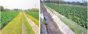
Figure 15(c): Teesta water in Indian canals (courtesy of Gogles).
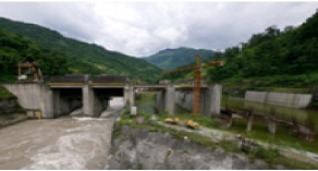
Figure 16(a): The dry bed of the world’s 8th largest river Ganges beside Rajshahi. By Donald Katz, the EngineerRower in Bangladesh , 2008, available at Figure 16 (b): The dry bed of the Garhai, the lifeline of the northwest pat of Bangladesh (Courtesy of The Daily Starr, 12:02 am Tuesday, October 21, 2014).
In course of time, India will put dam on the Barrack. And she is advancing with her grand river networking plan. India's weak water release into Bangladesh from the dammed rivers cause major sediment deposition in Bangladesh river beds, while inland sediment deposition in Bangladesh is heavy and coastal is light, coastal sediment deposition in India is heavy and inland is light. Bangladesh rivers are getting quickly silted. The dry bed and dry canals of the Teesta has been shown in (Figures 14 & 15). The dry condition results from the Mahananda Barrage and the Teesta Barrage (Figures 17a & 17b). (Table 3) shows the quantity of water pirated by India. Due to the Indian control of the Teesta water discharge, river bed has been silted heavily as shown in (Figure 14). In the flood season, the Indian released water through the gates easily makes the river flow above the danger mark and flood wide areas.
Figure 17(a): The Mahananda Barrage (Paithanker, 2013).
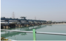
Figure 17(b): Teesta Barrage at Gajaldoba with 54 gates that controls water discharge in Bangladesh.
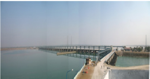
Figure 18(a): Some of the flood scenes due to opening of the gates of the Teesta Barrage at Gajaldoba and Farakka Barrage in West Bengal, India. Pictures speaks of the situations.
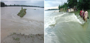
Figure 18(b): India opens the 54 gates of the Gajaldoba Barrage at her will and without notifying Bangladesh to let the outlet Bangladesh flood.

Figure 18(c): People are repairing the broken dyke.
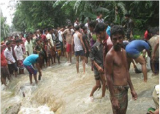
Figure 18(d): Flood situation deteriorates, more than a million peope are water-arrested.
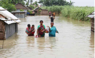
Figure 18(e): Flood situation deteriorates, more than a million peope are water-arrested.

Figure 18(f): Fear of flood in the middle and southern part of Bangladesh as the flood water recedes in the Bay of Bangal to the south; 14 people died in the northern part, July 30.
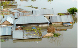
Figure 18(g): Train communication affected due to rail lines submergence.
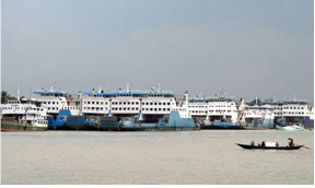
Figure 18(h): Ferry communication adversely affected due to the strong current at Shimulia-Keorakandi as Farakka Barrage gates have been opened.
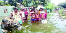
Figure 18(i): Ferry communication adversely affected due to the strong current at Shimulia-Keorakandi as Farakka Barrage gates have been opened.

Figure 18(j): People are trying to take shelter on high roads, Bangladesh losing land in Rajshahi due to the Ganges's erosion.

(Figures 18a-18j) Bangladesh losing land in Rajshahi due to the Ganges's erosion India occupies and fishermen fail to ascertain the borderline which make them lose their traulers at the hands on Indian BSF
Figure 19(a): Bihar flood in 2016.

Figure 19(b): flooding (Jagran Post Editorial, 9 Sept, 2013).

Indian Bihar State and Uttar Pradesh suffer from floods (Figures 19a & 19b). Experts have blamed the Farakka Barrage for the flooding (Bhatia, 2016; PTI, 2016). Losses of lives, damages to properties, and untold sufferings of peoples result from the dammed rivers that get their depths decreased and water accumulation capacity reduced.
Discussion
India has got her plan successful to the extent of not only setting up her National Water Way # 1 but also changing the course of the Ganges as shown in (Figure 3b) above and posted on one of their national websites. Indian national organ like the Indian Central Water Commission writes "The Ganga originates as Bhagirathi from the Gangotri glaciers in the Himalayas at an elevation of about 7010m in Uttarkashi district of Uttar Pradesh and flows for a total length of about 2525km up to its outfall into the Bay of Bengal through the former main course of Bhagirathi Hooghly.
Bangladesh has been suffering ever since the Death Trap Farakka Barrage and the Teesta Mahananda project operation started. Numerous meetings have taken place between the two countries at all levels [2, 3]. Those were only for killing time. India has far advanced. Current Indian Premier Modi got what former Premier Monmohan could not get from Bangladesh - transitivity in the name of connectivity. Bangladesh's Hasina government took a bold stand during Monmohan's visit but gave in during Modi's visit. India has captured water resources of and the land transportation through Bangladesh. Soft and fair words butter no parsnips Bangladesh's courteous approach to India, possibly, keeps a specific Bangladeshi political party in power at the cost of giving away Bangladesh’s renewable natural resources to India and the consequent sufferings of her people.
India's procrastination made Bangladesh river beds silted. One of the two main factors in sediment transport is the drag force controlled settling rate (Stoke settling) at which suspended sediment falls through a liquid. The other is the particle size dependent gravitational force [11]. The settling velocity is given by sediment_equation settling_velocity.
vs = (g * (ρp - ρf) * Dp2) / 18μ
vs= settling velocity
g = gravitational constant
ρp= particle density
ρf = fluid density
Dp= particle diameter
μ = fluid viscosity [12]
The sediment bed boundary layer shear stress explains the force water flow requires to overcome relative inertia and begin sediment transport [11].
sediment_equation_shear_stress
τ = ρf * u*2
τ= shear stress
ρf = fluid density
u* = characteristic velocity of turbulent flow (shear velocity) (see following equations) [12]
u* for a freshwater river system can be calculated as: sediment_equation_shear_velocity
u* =√(g * h * S)
u* = shear velocity
g = gravitational constant
h = river depth
S = river slope [12]
The shear stress gradually dies down as the water discharge is weakened through upstream piracy. The water body then becomes stagnant. All the sediment then clears of the water within a week’s time. In the quiescent fluid when the sediment loaded water stops flowing, the settling velocity ut can be calculated from the force balance. If the particle is falling in the viscous fluid under its own weight, then a terminal velocity, or settling velocity, is reached when this frictional force combined with the buoyant force exactly balances the gravitational force. This velocity v (m/s) is given by
v = (2/g) (ρp - ρf)/μ] g R2
(Vertically downwards if ρp >ρf, upwards if ρp < ρf), where:
a) g is the gravitational acceleration (m/s2)
b) R is the radius of the spherical particle.
c) ρp is the mass density of the particles (kg/m3)
d) ρf is the mass density of the fluid (kg/m3)
e) μ is the dynamic viscosity (kg/m*s).
Figure 20(a): Bihar flooding (Jagran Post Editorial, 9 Sept, 2013).
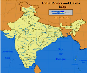
Figure 20(b): The bottle-neck part of West Bengal (Dirprivia, 2006).

India does not need the transitivity or connectivity through Bangladesh. She does not have the eastern part separated from the western part like the two wings of former Pakistan? India should develop her communication through the bottle neck of West Bengal (Figure 5 and Figure 20a & 20b)? That bottle neck part has a movement by the name of North Bengal. Right after Mamata's winning in election, she ran to the bottle neck part to subdue the movement. Today, Mamata had a chance to ask Delhi to develop the neglected bottle neck part instead of seeking connectivity through Bangladesh. It is an example that the birds of the same feather flock together. India Premier Monmohan came in with his group when the West Bengal Chief Minister Mamata Banarjee was expected to be accompanied but did not show up.
The next India Premier Modi could not accompany Ms. Banarjee, but she showed up separately. Monmohan called Mody as the best seller by using the tricks of replacing the word transitivity by connectivity. If these neo Indian leaders would realize the dignity of human beings, they would follow the teachings of their national leader Mr. Gandhi "The world has enough resources to meet everybody's need, but not to anyone's greed". At the cost shouldering piracy, lootings, and causing people's unbearable plights, they want to raise their nation in the list of rising powers. The next Indian Premier will, possibly, bring Mamata or whoever may be in her place. By that time all the river beds will be silted heavily and water release by India will inundate wider area than in the past. Bangladesh Rivers will be occupied by land grabbers. Bangladesh will not clamor for any water from India or if she clamors for it, India will then grant high interest loans to Bangladesh for partially dredging the rivers, which is an example of another investment of India in Bangladesh. Bangladesh has turned into a land of Indian investment.
India observes world Water Day pirating Bangladesh ecosystem's elixir. Had she not built so many dams and barrages, she did not have to face billions of dollars worth properties and lives in 2013 flood in her northern part. Bangladesh has a lot of points (briefly cited above) to raise for settling the water sharing issue. Since politicians' favorites are to cling to power of the country, they will remain satisfied with this while India advances with national developments. It is very unfortunate for Bangladesh that it lost two independent minded leaders. The current leaders do not have that independent personality. Bangladesh will never be able to gain the fair share of her elixir water under these leaderships. Bangladesh's specific political figures and their bureaucrats expect Indira Awards for their services rendered to the native land.
India does not honor any of the Helsinki Rules for international river water use. The Article 8 of the Helsinki Rules relates to "existing reasonable uses" India has set up the Mahananda Teesta project. She has got everything she planned. Now she is going ahead with the grandriver networking. It can be said that India has put the regional cooperation relating to transboundary rivers in cold storage.
Conclusion
With the change of the Ganges's course as she claims, all the upstream water resources are within her control. She is pleased and ready to go ahead. If Bangladesh takes these Indian steps for granted and if water piracy related effects do not move her an inch, Bangladesh, too, puts the regional cooperation in cold storage. As long as Bangladeshi politicians fight among themselves, think united they fall and divided they stand, like to trade in water for electricity, or in the wider sense like to grip and stay in power, the country cannot get the due share of water. Government bureaucrats have to be patriotic and use their far sighted outlook for the survivability of the future generation.
About the Tista water, on the bilateral basis, India is not going to affect her project by giving water to Bangladesh. Rather, she will wait until the river beds are raised with sediments. Whereas in Indian political arena birds of the same feather flock together on national interests, in Bangladesh birds of the same feather flock separately. Upstream riparian country India is at an advantageous position to corner her downstream little neighbor. Without remaining unyielding to the upstream neighbor, the little riparian country falls in helpless situations. Just to subjugate the little neighbor, the upstream country plays tricks after tricks. She forces to make the treaty, breaks the treaty, forms international organizations, violates the organizational rules, and treats the little neighbor the way she likes. Political polarization along with the selfish attitude of capturing power in the victim country go in favor of the upstream country. If the upstream country would realize the dignity and value of a human creature like the United States of America, she would not be dam blind.
References
- Osmond DL, Line DE, Gale JA, Gannon RW, Knott CB, et al. (1995) Turbidity in watershedss: water, soil and hydro-environmental decision support system.
- Adel MM (2015a) Farakka Barrage. Vol 1, Lap Lambert, Germany.
- Adel MM (2015b) Farakka Barrage Vol 2, Lap Lambert, Germany.
- Adel MM(2015c) The Dam-Deluged Gasping Ganges Vol 1, Lap Lambert, Germany.
- Adel MM(2015d) The Dam-Deluged Gasping Ganges Vol 2, Lap Lambert, Germany.
- Ahmed N, Brown J H, Muir J F (2008) Freshwater prawn farming in gher systems in southwest Bangladesh, Aquacul Econ Mgmt 12(3): 207-223.
- Ahmed N, Luong-Van J (2009) Can rice-fish farming provides food security in Bangladesh? Aquacul Asia Mag 14(1): 18-23.
- Ahmed N, Garnett ST (2010) Sustainability of freshwater prawn farming in rice fields in southwest Bangladesh, J Sus Ag 34 (6): 659-679.
- Ahmed N, Allison EH, Muir JF (2010) Rice fields to prawn farms: a blue revolution in southwest Bangladesh? Aquacult Int 18(4): 855-574.
- Ahmed N, Zander KK, Garnett ST (2011) Socioeconomic aspects of rice- fish farming in Bangladesh: opportunities, challenges and production efficiency. Austral J Ag Res Econ 55(2): 199-219.
- Crone T (2004) The basic sediment transport equations made ridiculously simple.
- Pattillo C (1994) Determining the Settling Velocity In Intro to Biochemical Engineering Term Project.
© 2018 Miah Muhammad Adel. This is an open access article distributed under the terms of the Creative Commons Attribution License , which permits unrestricted use, distribution, and build upon your work non-commercially.
 a Creative Commons Attribution 4.0 International License. Based on a work at www.crimsonpublishers.com.
Best viewed in


.jpg)


 Editorial Board Registrations
 Submit your Article
 Refer a Friend
 Advertise With Us
.jpg)


.jpg)


.bmp)
.jpg)
.png)
.jpg)


.jpg)


.png)

.png)


.png)


